|
Little Elk Creek Watershed Database and Mapping Project (DRAFT)
In addition to the Query Manager data and MARPLOT maps, this project serves information from an IMS site, plus also has a downloadable fact sheet and a web-based guide.
Introduction • top
This webguide was developed to provide information about the Little Elk Creek watershed in Cecil County, MD. There is concern about the watershed because of groundwater contamination coming from numerous active and inactive industrial facilities. The focus of the concern is the Triumph Industrial Park, comprising both operating and closed facilities, and other properties surrounding it. The Triumph Industrial Park is situated just west of the town of Elkton, MD. The area was first used as a fireworks and munitions production facility supplying military ordnance for World War II. Since closure of the munitions plant following the war, other manufacturing and industrial operations moved into the area. Dump sites and ordnance-related materials have been found in portions of the project area. Several facilities are performing investigations and/or cleanups under the U.S. Environmental Protection Agency (USEPA) or the State of Maryland’s Superfund and Resource Conservation and Recovery Act (RCRA) cleanup programs. The U.S. Army Corps of Engineers (USACOE) has identified portions of the target area as Formerly Used Defense Sites (FUDS).
Groundwater investigations have identified volatile organic contamination associated with active and inactive industrial facilities. Because the facilities in the study area fall under the jurisdiction of different federal and state cleanup programs, and there may be overlap between plumes from different facilities, the USEPA decided to include the area, as a pilot, in it's One Cleanup Program. Because the Little Elk Creek flows through the core of the industrial area, the name chosen for the pilot is "The Little Elk Creek Area-Wide One Cleanup Program Pilot".
NOAA's Involvement • top
NOAA has been working in cooperation with USEPA, the Maryland Department of the Environment (MDE) and the Maryland Department of Natural Resources (MDNR) on the Little Elk Creek pilot project. NOAA's main concerns are characterizing, protecting, and restoring aquatic resources (in particular, anadromous fish species) in Little Elk Creek and associated tributaries. The information is provided to project partners and the community for use in site revitalization planning and for community outreach and education. NOAA has developed a Geographic Information Systems (GIS) project and project specific GIS layers to help meet the goals of the Little Elk Creek pilot project.
 |
|
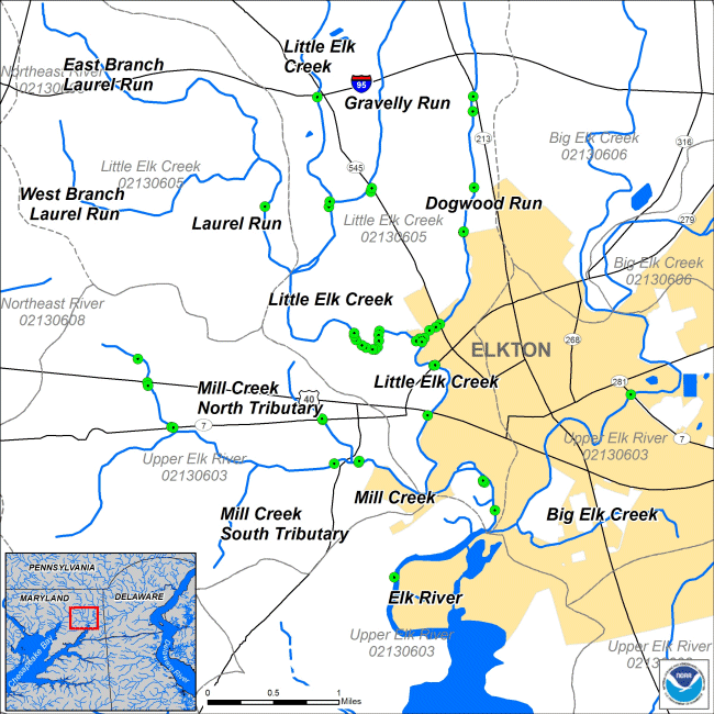
Overview Map of Little Elk Creek Watershed
|
Documents & Downloads • top
|
|
|
|
|
|
|
|

