
![]()
Have a Question or Comment?
What can we do to make this site more useful to you?
Note: Adobe Acrobat Reader required for PDF documents.
Problems accessing PDF documents?
Download the document to disk:
Mac Users: Option-click
PC users: Right-click
Last Updated:
![]()
|
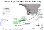
So you're coming to the Florida Keys Our national marine sanctuaries embrace part of our collective riches as a nation. Within their protected waters, giant humpback whales breed and calve their young, coral colonies flourish, and shipwrecks tell stories of our maritime history. Sanctuary habitats include beautiful rocky reefs, lush kelp forests, whale migrations corridors, spectacular deep-sea canyons, and underwater archaeological sites. Our nation’s sanctuaries can provide a safe habitat for species close to extinction or protect historically significant shipwrecks. Ranging in size from less than one square mile to over 5,300 square miles, each sanctuary is a unique place needing special protections. Natural classrooms, cherished recreational spots, and valuable commercial industries—marine sanctuaries represent many things to many people.
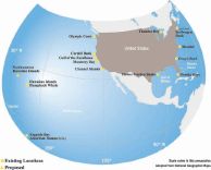
The National Marine Sanctuary Program serves as the trustee for a system of thirteen underwater parks, encompassing 18,000 square miles of marine and Great Lakes waters from Washington State to the Florida Keys, and from Lake Huron to American Samoa. The National Oceanic and Atmospheric Administration’s (NOAA) Ocean Service has managed National Marine Sanctuaries since passage of the Marine Protection, Research, and Sanctuaries Act in 1972. Protecting sanctuary resources requires a great deal of planning, management, and cooperation between federal, state, and local officials. The National Marine Sanctuary Program works cooperatively with its partners and the public to balance enjoyment and use with long-term conservation. Increasing public awareness of our marine heritage, scientific research, monitoring, exploration, educational programs, and outreach are just a few of the ways the National Marine Sanctuary Program fulfills its mission to the American people. The Program’s staff is ever mindful of their responsibility to protect America’s ocean treasures for this and future generations. |
 |
|
|
This complex marine ecosystem also supports tourism and commercial fishing, the economic foundation of the Florida Keys. In the last 20 years the tourism industry has grown to over four million domestic and foreign visitors who drive, fly or cruise each year to the most accessible tropical paradise in the Caribbean Basin. The Keys support 82,000 full-time residents. Tourists and semi-permanent residents increase this population by 75% during "season" (November to April). This ecosystem's extensive nursery, feeding and breeding grounds also support a multi-million dollar commercial fishing industry that lands nearly 20 million pounds of seafood and marine products annually.
In response to a growing awareness of the intrinsic environmental and cultural value of our coastal waters, Congress created the National Marine Sanctuary Program in 1972. The National Marine Sanctuary Act authorizes the Secretary of Commerce to designate specific areas as National Marine Sanctuaries to promote comprehensive management of their special ecological, historical, recreational, and esthetic resources. The National Oceanic and Atmospheric Administration (NOAA), Office of Ocean and Coastal Resource Management is responsible for management of the nation's Marine Sanctuaries. There are currently twelve National Marine Sanctuaries established in areas where the natural or cultural resources are so significant that they warrant special status and protection.
 |
|
|
As part of its establishment, a comprehensive management plan and water quality protection program was created for the Sanctuary in concert with the public, a citizen's advisory council, and several federal, state and local government agencies. Management in the state and federal waters is achieved through a cooperative agreement with the State of Florida Department of Environmental Protection and the Florida Fish and Wildlife Conservation Commission.
.JPG) |
|
|
The deterioration of the marine environment in the Florida Keys is no longer a matter of debate. There is a decline of healthy corals, signaled by an increase of coral diseases, coral bleaching, and decreased living coral cover. Marine scientists have reported an invasion of algae in seagrass beds and onto coral reefs. Fisheries scientists are reporting declines in some fish stocks and Florida Bay has undergone changes during the past decade that have resulted in degradation of the ecosystem, in terms of productivity, health, and stability of its living marine resources. Reduced freshwater flow in Florida Bay is one of the factors that has resulted in plankton blooms, sponge and seagrass die-offs, and fish kills.
 |
|
|
Knowledge-based Consensus Building
A series of workshops followed a set of public scoping meetings, and laid the foundation for building this Plan. At these work sessions, NOAA used a systematic process for obtaining relevant information from experts with knowledge of Sanctuary problems.
NOAA recognized that a useful management plan could not be developed and implemented without forging working teams to help provide the vision and knowledge necessary to accomplish the goals set forth in the FKNMSPA. Four teams were formed to ensure that input was provided by major Federal, State, and local interests in the Sanctuary, and to see that a plan was produced that met the goals and objectives set forth by the FKNMSPA and NOAA. There was considerable interaction, and some overlap in membership and function, among these teams.
- In July 1991, the Interagency Core Group, composed of Federal, State, and local agencies with direct jurisdictional responsibility in the Sanctuary, was formed to develop policies, and direct and oversee the management plan development process (Appendix B in Volume III lists the members of this Core Group).
- Sanctuary Planners held a series of workshops, from July 1991 through January 1992, which focused on a range of topics. The workshop topics included mooring buoys, education, photobathymetry, research, submerged cultural resources, and zoning.
- A Strategy Identification Work Group, composed of 49 local scientists and management experts, generated the initial set of strategies and details on implementation requirements.
- The Sanctuary Advisory Council (SAC) was established by the FKNMSPA to ensure public input into the Plan, and to advise and assist NOAA in its development and implementation. The SAC first met in February 1992 and conducted over 30 meetings that were open to the public (Appendix B in Volume III contains a list of SAC members). The SAC became an integral part of the Sanctuary planning process by serving as a direct link to the Keys' user communities, such as the dive industry, environmental groups, and commercial and recreational fishermen. In addition, the SAC has been instrumental in helping NOAA formulate policy, particularly with regard to: 1) the marine zoning plan, 2) activities needing regulation, and 3) recommending a preferred alternative for the Management Plan.
- A NOAA team composed of the Sanctuaries and Reserves Division, the Strategic Environmental Assessments Division, and the Office of the Assistant General Counsel for Ocean Services was responsible for developing and implementing the process to produce the Draft Plan. The Sanctuaries and Reserves Division is responsible for coordinating the review and producing the Final Management Plan and Environmental Impact Statement.
Focus on Management and Action
From the beginning of the Plan development process, it has been recognized that management is a continuous activity that must involve those responsible for implementing actions. The process has made maximum use of existing knowledge and experience to identify, characterize, and assess alternative management actions. Much of the planning process was devoted to identifying short- and long-term management actions or strategies, including their operational requirements. These management actions can be found in the detailed action plans contained in this volume. These plans address management issues ranging from channel marking, to volunteer programs, to regulations. They provide details on institutional needs, personnel, time requirements, and implementation costs. These details are necessary for the decisions that will have to be made upon Plan implementation by the managers in the region.
Toward Integrated, Continuous Management
A central purpose of the Management Plan is to take the disparate threads of protection and regulation that currently apply to the Florida Keys' ecosystem and weave them into a fabric of integrated coastal management (ICM). ICM is not a new idea or concept; what is new is the notion of applying it in a comprehensive and continuous manner. ICM is a process that begins with direct participation of managers, planners, analysts, scientists, and a concerned public. Developing an integrated management approach does not take place quickly; it evolves over time, based on incremental gains that build upon one another.
A major component of the Management Plan is the consideration of water quality issues and problems. The FKNMSPA called upon the U.S. Environmental Protection Agency and the State of Florida to develop a comprehensive water quality protection program for the Sanctuary. NOAA has incorporated this protection program into the Management Plan as the Water Quality Action Plan found in this volume.
The Draft Management Plan and Environmental Impact Statement (DMP/EIS) for the Florida Keys National Marine Sanctuary was released to the public at a Sanctuary Advisory Council meeting on April 4, 1995. This initiated a nine-month public review of the draft plan that ended December 31, 1995. During this review period, Sanctuary staff facilitated the public’s review of the plan in a variety of ways that were designed to maximize the public’s full understanding of the components and contents of the draft plan.
The nine month public review process included the following opportunities:
- Sanctuary Advisory Council Preview. On April 4, the draft plan was released in a public meeting. At this meeting, each of the authors of the Action Plans contained in the Preferred Alternative (Volume I) gave a verbal summary of the contents of the Action Plans. This day-long, detailed preview, initiated the public’s review of the draft plan and served to introduce and familiarize the public with the plan.
- Info-Expos. The Sanctuary staff held two series of three-day-long Info-Expos in April and May of 1995 and October 1995. The Info-Expos were held in the Upper, Middle, and Lower Keys. They were set up like a trade show and individual tables served as information booths manned by Sanctuary staff, Sanctuary Advisory Council members, Core Group members, and a Spanish interpreter. The Info-Expo staff passed out materials and answered the public’s questions about the draft plan. Each of the booths represented a specific theme such as water quality, fishing, boating, zoning, etc. Additionally, staff distributed copies of the draft plan to the public if they had not received one by mail.
- Working Groups. In June 1995, the Sanctuary Advisory Council established 10 Working Groups, one for each action plan, to assist in the public review of the draft plan. The SAC appointed a Chairperson for each of the Working Groups and other SAC members were encouraged to sign up to participate in the Working Groups that they were interested in monitoring.
In August 1995, the Sanctuary Staff gave the Working Groups a briefing outlining the purpose, objectives, and ground rules for the Working Group’s public review of the draft plan. The purpose of the Working Groups was to broaden the public’s review of the draft plan in order to get the best and most comprehensive review possible. An objective of the process was to help the SAC formulate their comments on the draft plan. The ground rules were: that membership on the Working Groups was open and the public was encouraged to sign up and participate; no voting (strive for consensus, but record both sides when split); all suggestions were to be recorded; the Working Group meetings were to be held in different parts of the Keys; and Sanctuary staff were to serve in a support role.
Each of the Working Groups held multiple meetings in various parts of the Keys. The public was given enormous opportunity to provide their input on the draft plan.
- Public Hearings. There were six public hearings held on the draft plan. The hearings were held in Miami, Key Largo, Marathon, Key West, St. Petersburg, and Silver Spring, Maryland. The Sanctuary Advisory Council was encouraged to attend as many of the meetings as possible in order to help the SAC further develop their comments on the draft plan. This made it possible for the SAC to take full advantage of the public’s comments in their deliberations on the draft plan in November and December.
As a result of the public review process, NOAA received over 6,400 statements of public comment on the draft management plan and environmental impact statement. Clearly, the use of the Sanctuary Advisory Council Working Groups assisted the advisory council in the development of their comments on the draft plan. As a result of their review process, the input at public hearings, and written public comments, NOAA has been able to develop a Final Management Plan that reflects a broad range of public comments.

