PODCASTS ABOUT PODCASTS ABOUT RSS
The GFDL Hurricane Model
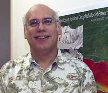
Interview with Morris Bender
July 18, 2007
 BARRY
REICHENBAUGH: This is Barry
Reichenbaugh with the NOAA Research Communications Office. I'm here at
the Geophysical Fluid Dynamics Laboratory in Princeton, New Jersey, with
Morris Bender.
BARRY
REICHENBAUGH: This is Barry
Reichenbaugh with the NOAA Research Communications Office. I'm here at
the Geophysical Fluid Dynamics Laboratory in Princeton, New Jersey, with
Morris Bender.
Morris, could you start first by giving us your title and then telling us what you do here?
MORRIS BENDER: Well, I'm a research meteorologist at GFDL where I have been working for the past 31 years with hurricane modeling, starting from 1976 when I began to work here under the leadership of Dr. Kurihara, who was one of the pioneers in hurricane modeling and who began the hurricane project here in 1970.
BARRY REICHENBAUGH: Can you tell me a little bit about the hurricane project and how that has evolved over the years?
MORRIS BENDER: Well, the hurricane project began here in 1970 through Dr. Kurihara, who actually began working at GFDL under the climate modeling branch. But, Dr. Smagorinsky wanted to expand GFDL to also be able to do mesoscale modeling. And, Dr. Kurihara, who was affectionately know as "Kuri" began the project. And, I began working here in 1976.
Originally, the intention was to develop a state-of-the-art hurricane model to study hurricanes as a basic research and to use the models of basic research tool. Over the next decade, the model was really one of the pioneers in the our numerical modeling of hurricanes and studied such things as hurricane decay over land, hurricane genesis, looked at hurricane structure.
And in the mid-80s, we were approached by Bill Bonner who was then the Director of NCEP (NOAA’s National Centers for Environmental Prediction), at that time called NMC (National Meteorological Center), about the potential of using our model as a hurricane forecast tool of the National Weather Service. At that point, we began a decade -- what turned out to be a decade-long effort -- to transfer a model that was used for basic research as a state-of-the-art hurricane forecast tool.
And, in the 90s, the model began to be tested in near-real time. The first near-real time forecast was for Hurricane Andrew. And, the model was actually run here but it was really the first forecast model to get Hurricane Andrew missing New Orleans. And, that actually got the attention of the Hurricane Center.
And, the next year, we ran a number of other storms and showed superior performance for track using our model compared to the other operational guidance. And, the model was -- the modeling system -- was then transferred to the National Weather Service, greatly optimized.
And, in 1995, became an official weather forecast model for the National Weather Service.
BARRY REICHENBAUGH: Can we talk a little bit about the collaborative process that has taken place in the development of the GFDL hurricane model?
MORRIS BENDER: Yeah. I think that our project was one of the real success stories of agencies in the government collaborating; that, first of all, the collaboration between us and NCEP was really very unique. Typically, agencies in the weather service try to adapt their own models but it was really a collaboration that really was a great success story that we were able to collaborate with the weather service.
And then, the collaboration expanded to the University of Rhode Island under Professor Isaac Guinness who began at GFDL. He was a post doc here in 1990 through '92. He immigrated to United States from Russia and, kind of one of those ironic twists that when he immigrated here, he settled in an area only about 30 miles from GFDL. And, he knew about GFDL from Russia. And, he was interested in ocean -- studying the interaction of hurricanes with the ocean. And, that was, at that time, people -- many people didn't believe that that interaction of the hurricane with the ocean was important.
And so, we began a two-year collaboration to study that. And, when he left to go to the University of Rhode Island, that collaboration continued and evolved into developing a hurricane ocean coupled model. And, which eventually became operational.
So, that collaboration has continued and has been very important, actually, in further improving our model. Over the last few years, he and some of his post doc and Ph.D. students worked with us in improving how the hurricane can be able to simulate the flux of energy from the ocean. We call them surface fluxes, as well as improving this hurricane coupling effect, as well as helping us in increasing the model resolution -- some of the other physics.
So, it was a really incredible success story of collaboration between not only us, which was a research lab but also the weather service, as well as an academic institute, something which isn't really done as often as it should be successfully. But, it's been a great collaboration.
And, the reason the collaboration has been so successful is that we were all able to work together. I'm a firm believer in collaboration but realize that collaboration often start with friendships and people that can really work together. And, the fact that we, as well as people at the University of Rhode Island, as well as people in NCEP really were good friends, the collaboration has been a tremendous success.
BARRY REICHENBAUGH: Where should we anticipate future improvements in the field of hurricane modeling?
MORRIS BENDER: Well, as you know, over the last decade, we've seen an unprecedented improvement in hurricane tracks forecasting. Much of that has been because of the collaboration of us and the National Weather Service. Not only did the GFDL model improve the overall consensus of the track models, but some of the work that we had done in our hurricane model actually was also adapted by the Weather Service's global model and some of the ideas that we developed. And so, that has shown some great improvements in track.
But, intensity has not shown really a steady improvement. Actually, the last year of our model, 2006, was the first time that our model did show significant intensity skill but because we were able to put into the model some of the higher resolution physics that we were not able to do because of computer limitations. Well, all that to say is that what we really are trying to address now is the issue of intensity.
And, that's gonna take a number of things. First, as the computer power increases to be able to have higher resolution models.
Number two, to be able to better get -- capture the initial structure of the hurricane.
Number three, to be able to have better representation of the physics. And, in particular, the physics dealing with the surface of the ocean and the exchange of those -- what we call those fluxes from the surface of the ocean to the hurricane.
That's not well understood but there is some pioneering work being done now with that. And, over the next ten years, we really think that those fluxes are gonna be much better represented and that's gonna also lead to big improvements in intensity.
One of the places that I really think where we're gonna be pioneering some of that work is the University of Rhode Island. And so, GFDL hopes to continue collaborating with the University of Rhode Island with that improvement in the physics of what we call the surface fluxes.
BARRY REICHENBAUGH: Sounds like there are gonna be some interesting developments coming. I'm wondering if you could shift a little bit with me now and just, if I could, ask you how you got into this career field and --
MORRIS BENDER: Sure.
BARRY REICHENBAUGH: -- what got you interested in science in the first place.
MORRIS BENDER: Well, I was always interested in the weather growing up. You know, there are a number of people that really become what we call weather addicts, that we get really fascinated with the weather. I was one of them. And, when I actually started in college, I started as a music major with a piano principle. But, I recognized that I really didn't want to make a living with music. Music was a very nice part of my life.
And, I was -- ended up switching to major in math and physics with the idea of going on into meteorology as a career. So, it was really something. You know, you like to have a career doing what you like to do the most. And, I really, really, really was fascinated with the weather. So, that's basically, in a nutshell, how I got into meteorology.
BARRY REICHENBAUGH: What kind of advice do you offer for someone who is considering a career in science?
MORRIS BENDER: I'm gonna think about this. Well, I think that it's always just kind of interesting. In some ways, I wish I was 30 years younger because, you know, there are so many interesting areas in meteorology, first of all, that are opening up. And, you kind of wish you could kind of be there to kind of be part of it. I think it's exciting that, you know, with the -- in our field, numerical modeling of weather -- that the computers are getting so powerful -- that there are just so many interesting possibilities out there in the next ten, 20 years in the field of hurricanes -- that I think that we're going to really explode in our knowledge of some of these issues of, you know, how a hurricane, you know, interacts with the ocean and how the energy gets, you know, drawn into the storm.
And, understanding as the sort of things, you know, with the computer power, we can really be able to put the physics, you know, be able to model the physics really very, very real detailed, which we hadn't been able to be able to do before. And, it's kind of really exciting. I think we're gonna greatly increase our knowledge of hurricanes, understanding the intensity.
People to understand that it's not that we didn't know where to go with models for intensity, but it was so much limited by our computer resources. And so, I think there's going to be some great, great improvements and breakthroughs in our knowledge of hurricanes. Of course, as well as weather in general.