Outlooks

Hazardous Weather Outlook for Western South Dakota and Northeastern Wyoming

The Hazardous Weather Outlook describes significant weather expected during the next seven days.

National Thunderstorm Outlooks from the Storm Prediction Center

SPC Day 1 Convective Outlook (click for details)
Today's Outlook Text
SPC Day 2 Convective Outlook (click for details)
Tomorrow's Outlook Text
SPC Day 3 Convective Outlook (click for details)
Day 3 Outlook Text
Experimental SPC Day 4-8 Convective Outlook (click for details)
Experimental 4-8 Day Outlook Text

Mesoscale Discussions

Mesoscale discussions are issued to describe conditions which may produce severe thunderstorms, heavy rain, heavy snow, and other significant weather.

Current Mesoscale Discussions in Effect (click for details)
Mesoscale Discussions

Fire Weather Outlooks from the Storm Prediction Center

Day 1 Fire Weather Outlook (click for details)
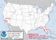
Day 1 Fire Weather Outlook Text
Day 2 Fire Weather Outlook (click for details)
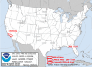
Day 2 Fire Weather Outlook Text

Excessive Rainfall Outlooks

Winter Weather Outlooks


  • NOAA's National Weather Service
  • Rapid City, SD Weather Forecast Office
  • 300 East Signal Drive
  • Rapid City, SD 57701-3800
  • 605-341-9271
  • Page Author: UNR Webmaster
  • Web Master's E-mail: w-unr.webmaster@noaa.gov
  • Page last modified: August 15th 2006 6:27 PM
USA.gov is the U.S. government's official web portal to all federal, state and local government web resources and services.