Resource Record Details
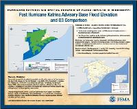
Hurricane Katrina: GIS Spatial Analysis of Flood Impacts in Mississippi- Post Hurricane Katrina Advisory Base Flood Elevation and Q3 Comparison
 Immediately after Katrina, FEMA conducted assessments of coastal flood elevations, called ABFEs in Mississippi and Louisiana to provide State and Local officials with more accurate data and to guide local decisions regarding reconstruction. Since flood damage is not covered under homeowners insurance, residents of structures without flood insurance could only recoup damages caused by non-flood sources.
Document Details:
| Resource Type: |
Poster |
| Audience Categories: |
Mapping Professionals
|
| Hazard Types: |
Coastal Storm
Hurricane/Tropical Storm
Flooding
|
| Subjects: |
Public Outreach and Education
Mapping and Geographic Information Systems (GIS)
|
| Series: |
ESRI Poster Display
-
HAZUS-MH Building Counts Affected: 100-Year Flood Exceedance and Potential Elevation Requirement, New Orleans, Louisiana
Harrison County, Mississippi: Advisory Base Flood Elevation to Existing Ground Elevation Differential
Pass Christian, Mississippi: Relating Observed Flood Damage to the Flood Insurance Rate Map
Residential Substantially Damaged Buildings in Relation to the Katrina Surge Inundation and Advisory Base Flood Elevations
Flood Map Modernization
After Hurricane Katrina: FEMA Flood Recovery Mapping
Katrina - Rebuilding Efforts: Why FEMA Created Katrina and Rita Flood Recovery Maps
Katrina - Rebuiding Efforts: Orleans Parish Advisory Base Flood Elevation Maps
Hurricane Katrina: Ratio of Modeled Peak Gust Wind Speeds to Design Peak Gust Wind Speeds
HAZUS Evaluation of 1906 Magnitude Earthquake in Today's Environment - Displaced Households
HAZUS Evaluation of 1906 Magnitude Earthquake in Today's Environment- Economic Loss
Potential Loss of Functionality: Hospitals, Hurricane Katrina
Design Level Exceedance- Peak Gust Wind Speeds, Hurricane Katrina
Hurricane Katrina Estimated Water Depth for HAZUS-MH Loss Estimation, New Orleans, Louisiana
HAZUS-MH Estimated Peak Gust Wind Speeds: Hurricane Katrina
Hurricane Katrina: GIS Spatial Analysis of Flood Impacts in Mississippi- Damaged Primary Residences Outside the High Risk Flood
Residential Substantially Damaged Buildings in Relation to the Advisory Base Flood Elevation and Q3
Mapping for Decision Makers
Mapping for Decision Makers
Mapping the 100-Year Floodplain is Not the End of the Story
Using HAZUS-MH for Mitigation Planning Efforts
Using HAZUS-MH to Promote Seismic Safety
Taking Shelter From the Storm
Flood Map Modernization - Then and Now: Flood Mapping from Paper to Digital
FEMA Digital Flood Hazard Data Products
Mapping Project Tracking Systems
Cooperating Technical Partners: The Flood Control District of Maricopa County, Arizona
How Many People Live in Coastal Counties?
Number of Severe Repetitive Loss Properties per County
Harris County, Texas Severe Repetitive Loss Structures
Using HAZUS-MH and GIS to Measure Mitigation Successes - Red River Flood
Point Symbology for Emergency Management
|
Download Plug-in
Some of the links on this page require a plug-in to view them. Links to the plug-ins are available below.
 Adobe Acrobat (PDF)
 Immediately after Katrina, FEMA conducted assessments of coastal flood elevations, called ABFEs in Mississippi and Louisiana to provide State and Local officials with more accurate data and to guide local decisions regarding reconstruction. Since flood damage is not covered under homeowners insurance, residents of structures without flood insurance could only recoup damages caused by non-flood sources.
 This is a large file and may take considerable time to download on slower connections. Consider adding this to your Bookshelf and then using the "CD on Demand" feature upon checkout instead.


 My Bookshelf