HAZUS: HAZUS-MH Uses: Map Series
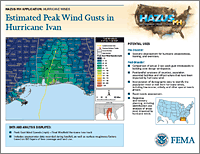
The intent of the HAZUS-MH Map Series Templates, which was launched in 2006, is to share innovative HAZUS-MH products that have been developed since 2005 to support risk assessments, mitigation planning and support for disaster operations. A standardized template has been developed to display the maps with descriptions of the data and analysis. Each map includes an explanation of how the analysis can be used to support decision making for hurricanes, floods and earthquakes. The map templates are available as Handouts or Posters.
Last Modified: Monday, 03-Mar-2008 16:26:58 EST
Fast Facts
Potential loss estimates analyzed by HAZUS-MH include physical damage to residential and commercial buildings, schools, critical facilities, and infrastructure; Economic loss, including lost jobs, business interruptions, repair and reconstruction costs; and Social impacts, including estimates of shelter requirements, displaced households, and population exposed to scenario earthquakes, hurricane winds, and floods.
References
- HAZUS-MH for Mapping Decision Makers Posters
- HAZUS-MH Best Practices: State of Florida
- HAZUS-MH Order Form
 Email Updates