HAZUS-MH Overview
The Hazards U.S. Multi-Hazard (HAZUS-MH) is a nationally applicable standardized methodology and software program that estimates potential losses from earthquakes, hurricane winds, and floods. HAZUS-MH was developed by the Federal Emergency Management Agency (FEMA) under contract with the National Institute of Building Sciences (NIBS).
HAZUS-MH uses state-of-the-art Geographic Information Systems (GIS) software to map and display hazard data and the results of damage and economic loss estimates for buildings and infrastructure. It also allows users to estimate the impacts of earthquakes, hurricane winds, and floods on populations.
Estimating losses is essential to decision-making at all levels of government, providing a basis for developing mitigation plans and policies, emergency preparedness, and response and recovery planning.
In the newest version of HAZUS-MH, HAZUS-MH MR3 (HAZUS-MH Version 1.3), the Flood Model will run building analyses faster and users may import user-supplied flood maps and flood depth grids. The Hurricane Model boasts an updated and revised historical database that includes storms from 2004 and 2005. New vulnerability functions will permit calculation of additional losses to manufactured housing due to tree blowdown. Changes to the Earthquake Model include adjustable population distribution parameters in the casualty module and the elimination of partial ignitions in the fire-following module. For information on software and hardware requirements to run HAZUS-MH, see HAZUS-MH Hardware and Software Requirements.
Order HAZUS-MH
Contact:
FEMA Distribution Center
P.O. Box 2012
Jessup, MD 20794-2012
Phone: 1-800-480-2520
Fax: 301-362-5335
Click here for the order form.
HAZUS Overview Handout
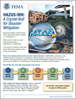
HAZUS-MH: A Crystal Ball for Disaster Mitigation
How many homes would be lost if this hurricane makes landfall as a Category 3? What are the costs to repair infrastructure after a Magnitude 7 Earthquake? If we spent $2 million to buy out these flood-prone homes, what is the cost-benefit? This overview explains how HAZUS-MH combines science, engineering and mathematical modeling with GIS technology to estimate losses of life and property—and shows those losses on a map. Use this handout to rally support for hazard mitigation. Create customized maps and graphics to show buildings, roads, rivers, coastlines, and infrastructure damages. By visualizing your hazard risks you can make a compelling case to decision makers about the need for mitigation. (05/2008)
Last Modified: Saturday, 16-Aug-2008 14:39:16 EDT
Fast Facts
HAZUS-MH produces loss estimates based on state-of-the-art scientific and engineering knowledge and software architecture. These estimates are essential for decision-making at all levels of government, and are a basis for developing mitigation plans and policies, emergency preparedness, and response and recovery planning.

 Email Updates