Valued for its recreation opportunities, natural beauty, timber, watersheds, water, forage, and wilderness resources, the forest is managed to give the American people the greatest benefits that can be produced on a permanent basis.
The Cibola National Forest is 1,625,542 acres in size. Elevation ranges from 5,000-11, 301 feet. Our forest includes the Datil, Gallinas, Magdalena, Bear, Manzano, Sandia, San Mateo, Mt. Taylor, and Zuni Mountains. There are four wildernesses contained within our forest: the Sandia Mountain, Manzano Mountain, Withington, and Apache Kid. The Cibola National Grasslands are located in northeastern New Mexico, western Oklahoma, and northwestern Texas, and are 263,954 acres in size.
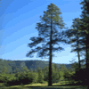
Climate varies with elevation from desert up through juniper, pine, and spruce-fir forests. Sandia Crest, elevation 10,678 feet, is accessible by road, aerial tramway, and trails. Capillia Peak, elevation 9,375 feet, is accessible by road and trails. Mount Taylor, elevation 11,301 feet, has a good road to within a mile of the top. There are several other scenic drives available. Season of recreational use is all year, although the high country winter is severe. Summer nights are cool, cold above 8,000 feet. July and August have frequent afternoon showers due to the monsoon season.
On the Cibola there are hunting opportunities for deer, elk, antelope, and turkey. There are fishing opportunities in Bluewater and McGaffey Lakes in the Zuni Mountains; Skipout, Spring Creek, and Dead Indian Lakes in Oklahoma; and Lake Marvin and Lake McClellan in Texas.
Downhill skiing is available at the Sandia Peak Ski Area, located on the east side of the Sandia Mountains. Located in the vicinity of the Cibola National Forest are Indian Pueblos, prehistoric ruins, ice caves, and lava flows. |
