Hurricane Rita Flood Recovery Maps
Background
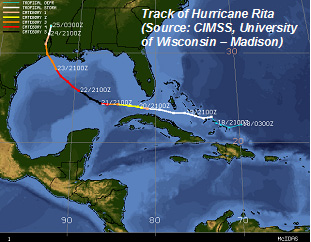
On September 24, 2005, Hurricane Rita made landfall near the Louisiana-Texas border as a Category 3 hurricane, with maximum sustained winds of 120 miles per hour. Reaching Category 5 status while in the Gulf of Mexico but weakening before landfall, Hurricane Rita caused extensive coastal flooding, erosion, and wind damage. Sustained, hurricane-force winds extended more than 150 miles inland, and tropical storm-force winds reached the Arkansas-Louisiana-Texas border.
Storm surge elevations from Hurricane Rita have been estimated at 15 feet near the landfall site. The surge plus wave action caused widespread damage to infrastructure and buildings throughout low-lying coastal communities and inland parishes. The storm’s flooding impacts were not limited to the landfall area; surge of up to 8 feet was observed in New Orleans, breaching levees that had been provisionally repaired after Hurricane Katrina. As the storm moved inland and became a Tropical Storm, heavy rainfall also caused localized flooding.
(Storm information compiled from reports published by the National Oceanic and Atmospheric Administration [NOAA]: http://www.ncdc.noaa.gov/oa/climate/research/2005/rita.html)
In response to this devastating hurricane, the Federal Emergency Management Agency (FEMA) initiated a project to produce high-resolution maps that show flood impacts from the storm for portions of nine coastal Louisiana parishes: Calcasieu, Cameron, Iberia, Lafourche, St. Charles, St. John the Baptist, St. Mary, Terrebonne, and Vermilion. While flooding impacts from Hurricane Rita were also severe in Texas, recovery maps were only prepared for Louisiana because the observed coastal flooding was significantly greater than the flood levels shown on current Flood Insurance Rate Maps (FIRMs), suggesting that the FIRMs may understate the true flood risk.
The Hurricane Rita Surge Inundation and Advisory Base Flood Elevation Maps (also referred to as “Rita Recovery Maps”) can be viewed at the Maps link on this site. These maps show preliminary high water mark flood elevations and flood inundation limits from Hurricane Rita.
In addition to information about Hurricane Rita’s impacts, the Rita Recovery Maps also show coastal Advisory Base Flood Elevations (ABFEs). These ABFEs are based on a flood frequency analysis completed by FEMA that updates the flood risk data with information on storms that have occurred in the 25+ years since the FIRMs were published, including (but not limited to) Hurricanes Katrina and Rita.
These Rita Recovery Maps are intended to help state and local officials, as well as homeowners, to identify existing and increased flood hazards caused by Hurricane Rita and other storms that have struck this region in the last 25 years, and to use this information during recovery and redevelopment to avoid future flood damages.
Last Modified: Monday, 27-Mar-2006 20:04:10 EST