HAZUS: Preparedness and Response
FEMA Uses HAZUS-MH in Support of Disaster Operations
HAZUS-MH Used in Support of Hurricane Operations
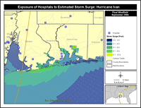
During the 2004 hurricane season, important strides were made in the application of HAZUS-MH in support of hurricane disaster operations in Florida and Alabama. The loss estimation methodology and software application was used by the Mitigation Directorate in support of FEMA’s Response Division, and was also used at the Regional Operations Center (ROC) in Atlanta. The following links highlight the experience and lessons learned from the deployment of HAZUS-MH to the ROC during Hurricane Ivan. Additional links highlight the role of HAZUS in earthquake planning.
Using HAZUS-MH to Support Response to Hurricane Ike
As Hurricane Ike approached landfall in southeast Texas on September 13, 2008, officials at FEMA’s Mapping and Analysis Center (MAC) were in daily contact with HAZUS subject matter experts. FEMA’s HAZUS-MH team generated a suite of map-based products following each National Hurricane Center (NHC) advisory. For planning purposes, a key HAZUS-MH output is Estimated Maximum Sustained Wind Speeds. When used in conjunction with surge analysis, this template presents a useful snapshot of the exposure of the population and essential facilities to high winds and storm surge from Hurricane Ike. The ability to depict estimated damages on a regional (multi-county) scale is an added advantage. Find out how HAZUS-MH was used to support the Ike response operations.
HAZUS-MH Hurricane Operations Course Delivered at Florida Governors’ Hurricane Conference (May 12-16, 2008)
A two-day training session – Use of HAZUS-MH for Hurricane Disaster Operations – was conducted in Fort Lauderdale, Florida in conjunction with the Florida Governors’ Hurricane Conference. The course brought together FEMA, State and local emergency managers and Geographic Information System (GIS) professionals to take part in an intensive training session on the preparation and use of map-based HAZUS-MH templates or hurricane impact assessments and response operations.
HAZUS-MH Used in Two Integrated Emergency Management Courses (IEMC) 
HAZUS-MH was successfully used in two Integrated Emergency Management Courses/Hurricane Recovery and Mitigation – one that focused on South Carolina and the other on Mobile, Alabama. These courses bring together State and local officials from the “study area” to develop and implement recovery and mitigation strategies following a major disaster.
Estimating Potential Impacts of Hurricanes
On September 13, 2004, the ROC at FEMA Region IV in Atlanta, Georgia, was activated in anticipation Hurricane Ivan’s landfall in the southeastern U.S. The team blended expertise in the operation of HAZUS-MH and the use of HAZUS-MH analyses to support hurricane impact assessment and disaster response.
Lessons Learned from 2004 Hurricane Season
HAZUS-MH is highly sensitive to hazard input. Priority needs to be given to procedures for obtaining the most accurate hazard data from the National Hurricane Center and other sources.
HAZUS-MH Best Practices: State of Florida
The State of Florida has been a leader since 2004 in the use of HAZUS-MH to support decision-making in response operations, mitigation planning and post-disaster analysis of recovery options and strategies. This best practice article highlights the important HAZUS-MH initiatives that have been carried out in Florida through the leadership of the Florida Division of Emergency Management in close coordination with FEMA Region IV and the Florida HAZUS Users Group (FLHUG).
FEMA Supporting a Comprehensive Data Management System (CDMS) Web-Portal Project for Florida
FEMA announced that it is funding a CDMS Web Portal project in Florida, which will complement a similar project that is underway in South Carolina. The CDMS Web portal enables users to import and manage HAZUS-MH data through the Web. All that is needed is a browser and either Excel or Access. This functionality, and ability to access and share large datasets from multiple locations, represents an important breakthrough in HAZUS-MH technology. More information and to download CDMS.
HAZUS-MH Used in Support of Earthquake Operations
HAZUS-MH Used to Map Indiana EarthquakeOn April 18, 2008, a magnitude 5.2 earthquake occurred in the Wabash Valley Seismic Zone, centered about six miles from Mount Carmel, Illinois and about 131 miles east of St. Louis, according to the U.S. Geological Survey. The ground shaking was felt in parts of southern Illinois and Indiana, causing non-structural damage in Wabash County, Illinois and surrounding counties. A team from FEMA Region VIII conducted a HAZUS-MH run to compare observed damages and reported damages.
HAZUS-MH Used in Support of Utah Seismic Safety Legislation 
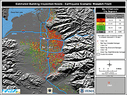
The State of Utah has recently taken important steps to reduce the vulnerability of schools to damaging earthquakes in the Wasatch Front region. House Bill 162, requires a seismic evaluation of public schools, and appropriates funding to support seismic safety. HAZUS-MH has played an important role in this initiative. The model has sharpened the focus on the vulnerability of schools in this region to damaging earthquakes. Specifically, HAZUS-MH has been used to estimate losses and potential casualties from scenario earthquakes in a region that is among the most susceptible in the U.S. to seismic activity.
California Uses HAZUS-MH to Reassess Safety of Hospitals
In November, 2007, the California Building Standards Commission approved the use of the HAZUS-MH Advanced Engineering Building Module (AEBM) to re-evaluate hospitals in California. HAZUS-MH is playing a central role in the vulnerability analysis of over 1,300 hospitals that were built in California before 1973. The findings of this analysis have significant cost implications for the state.
HAZUS-MH Used to Support San Francisco Bay Area Earthquake Exercise
On November 16, 2006, California officials concluded a major, joint Federal, State, and local California statewide exercise entitled "Golden Guardian '06 (GG06)" following 36 hours of play focusing on a catastrophic San Francisco Bay Area earthquake. HAZUS-MH was used to support the exercise, simulating a repeat of the 1906 San Francisco earthquake.
Role of HAZUS in Catastrophic Earthquake Planning
The Role of HAZUS in Catastrophic Earthquake Planning was among the topics that were explored at a Workshop on Strategic Directions for Seismic Risk Modeling and Decision Support, sponsored by the Mid-America Earthquake Center (MAE).
Application of HAZUS to the New Madrid Earthquake Project
This presentation includes details of the Study Region Overview and Characteristics, HAZUS Level 1and 2 analysis for Magnitude 6.5 earthquake, and the results for six functional areas of the New Madrid Earthquake Project.
HAZUS-MH: Preparedness and Response Planning 
Which essential facilities in your region may be impacted by an earthquake? Will the local hospitals be functional three days after a hurricane? What routes should emergency vehicles travel to avoid flood waters? HAZUS-MH has the answers! HAZUS-MH combines science, engineering and mathematical modeling with GIS technology to estimate losses of life and property. HAZUS-MH estimates impacts to the physical, social and economic vitality of a community from earthquakes, hurricane winds and floods. HAZUS-MH is the tool that state and local governments use in all phases of emergency management planning. HAZUS-MH is used to create customized maps showing hazard risks to decision makers, community leaders and project managers. HAZUS-MH is a modeling tool that provides data to strengthen preparedness and response capabilities by assessing risk and forecasting losses. HAZUS-MH regional loss estimates have been validated and proven to be accurate.
Using HAZUS-MH to Promote Seismic Safety
HAZUS-MH has become a valuable tool for risk and emergency managers at all levels of government and the private sector. The earthquake model has been used to carry out National studies of annualized earthquake loss, to develop scenarios for catastrophic planning, to support evaluations of seismic safety of hospitals and other essential facilities, and to support risk assessments and mitigation planning in seismically vulnerable regions of the United States. This handout highlights several projects, studies, and map templates that can be used to support this effort.
California Office of Emergency Services
HAZUS: Getting Back to Business
Last Modified: Monday, 01-Dec-2008 15:05:23 EST
Fast Facts
HAZUS-MH combines science, engineering and mathematical modeling with GIS technology to estimate losses of life and property. HAZUS-MH is used to create customized maps showing hazard risks to decision makers, community leaders and project managers. HAZUS-MH is a modeling tool that provides data to strengthen preparedness and response capabilities by assessing risk and forecasting losses.
References
- HAZUS-MH: Information You Need for a Map-Based Disaster Exercise
- HAZUS-MH:“Out of the Box” Emergency Management Applications
- FEMA 366 - HAZUS-MH Estimated Annualized Earthquake Losses for the United States

 Email Updates