Grand Mesa, Uncompahgre and Gunnison National Forests
| Home | |
| About Us | |
| Contact Us | |
| Current Conditions | |
| FAQs | |
| Fire | |
| Jobs | |
| Maps & Brochures | |
| Newsroom | |
| Passes & Permits | |
| Projects & Plans | |
| Publications | |
| Recreation | |
| Volunteering | |
or Grassland (NG)
Grand Mesa, Uncompahgre and Gunnison National Forests Telephone for the |
|
|
|
Welcome
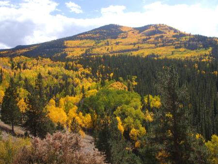
The Grand Mesa, Uncompahgre and Gunnison National Forests are a combination of separate National Forests located on the western slope of the Colorado Rockies. These three combined Forests cover 3,161,912 acres of public land in the central and southern Rocky Mountains, an area that lies south of the Colorado River and west of the Continental Divide with some of the most spectacular scenery in the Rockies. The Forests vary in elevation from 5,800 feet above sea level in Roubideau Creek Canyon to 14,309 feet on Uncompahgre Peak. The Forests include spectacular features like the 355 foot high Bridal Veil falls; the Grand Mesa with over 300 lakes, one of the world's largest flat top mountains; and Alpine Tunnel, once the highest railroad tunnel in North America. Other Forest facts for 2008.
Photo by John Stites 9/26/08 |
USDA Forest Service - Grand Mesa, Uncompahgre and Gunnison
National Forests
Last Modified:
Wednesday, 12 November 2008 at 14:49:35 EST
For Visitor Information, please contact GMUG
Visitor Information
If you have problems regarding this website, please contact the Web
Manager