Connecting to HGDW Map Data With ArcExplorer Java Edition
This page describes the steps necessary to use the free Java-based ArcExplorer tool from ESRI
to connect to and use the HRSA Geospatial Data Warehouse feature data service (HGDW_Mapping)
located at datawarehouse.hrsa.gov. (You can download and install the software from the ESRI
website by visiting http://www.esri.com/software/arcexplorer/about/arcexplorer9.html
Once you have obtained and installed the software, follow these steps to connect to and use the
HRSA Geospatial Data Warehouse data.
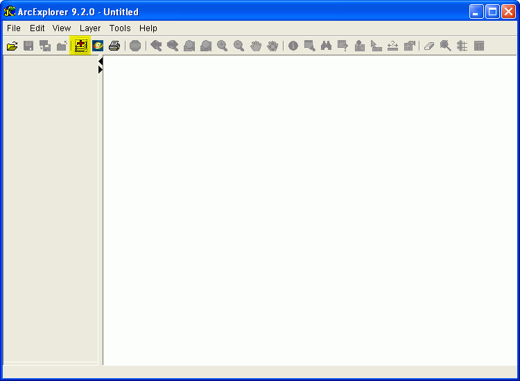
STEP 1: Open ArcExplorer. Then click the "Add Data" button ( ) on the tool bar to open the Catalog tool.
This button is highlighted in the screen image below. ) on the tool bar to open the Catalog tool.
This button is highlighted in the screen image below.
FIGURE 1: The ArcExplorer map interface
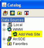
STEP 2: Click the plus sign next to the "WWW" entry under "Data Sources" to reveal the "Add Web Site" option. Figure 3 shows the Catalog table of contents
as it appears when you have done this. The "Add Web site" option is highlighted.
FIGURE 2: The ArcExplorer Catalog tool
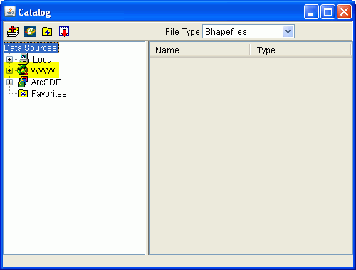
FIGURE 3: The Add Web Site option
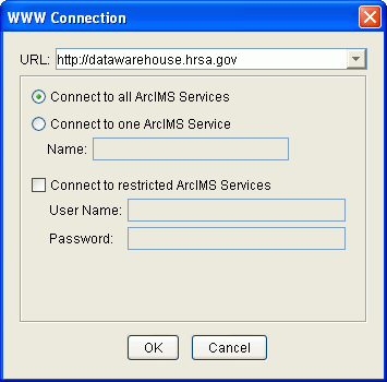
STEP 3: Double-click the "Add Web Site" option to open the WWW Connection dialog box:
FIGURE 4: The WWW Connection dialog box
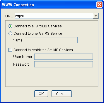
Enter the web address of the HRSA Geospatial Data Warehouse (http://datawarehouse.hrsa.gov) as shown in Figure 5 below and click the OK button. Leave the default option "Connect to all ArcIMS Services" selected.
FIGURE 5: WWW Connection information for the HRSA Geospatial Data Warehouse
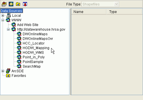
STEP 4: After you click OK, the Catalog tool displays a list of all of the map services in the HGDW website.
FIGURE 6: The Catalog Tool, showing the map services in the HRSA Geospatial Data Warehouse
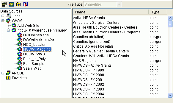
STEP 5: Select the service named "HGDW_Mapping". The Catalog
tool will list all of the layers available in the HGDW_Mapping map service.
FIGURE 7: The Catalog tool with the layers of the HGDW_Mapping service shown
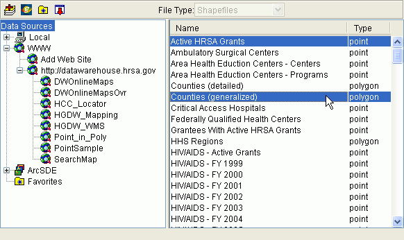
STEP 6: From the list of layers in the right hand pane of the Catalog window, select
the map layer(s) you want to use. In the example shown here, the "Active HRSA Grants"
and "Counties (Generalized)" layers are selected.
FIGURE 8: Selecting individual layers from the map service
STEP 7: When you are done selecting layers, Click the "Add Data" button ()
on the Catalog tool bar to add the selected layer(s) to your ArcExplorer map. If you are finished
working with Catalog, you can close the tool using the "Close" button ( )
on the toolbar. Otherwise, you can click the main ArcExplorer map window to activate it and start
working with your map. )
on the toolbar. Otherwise, you can click the main ArcExplorer map window to activate it and start
working with your map.
STEP 8: Once you have added some or all of the layers in the HGDW_Mapping service to your map,
the Table of Contents in ArcExplorer should look similar to this:
FIGURE 9: ArcExplorer map interface with layers added
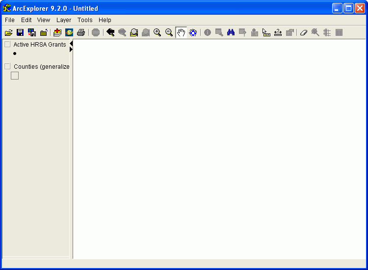
When you add new data, it is left "turned off" (not drawn) by default.
Use the check box next to each layer's name to cause it to be drawn or hidden.
From this point, you should be able to work with the data just as if it were in
a data source (shape file or ArcSDE database) on your own system. Remember that as
the data in the HGDW changes you may see different features. Each time the data in
the HGDW are updated, the change is noted on the Data Refresh Dates page of the HGDW
website.
|