Hurricane Katrina Flood Recovery Maps
Hurricane Katrina
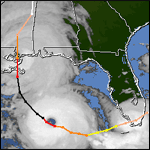
Hurricane Katrina was a long-lived hurricane that made landfall three times along the United States coast and reached Category 5 at its peak intensity. The storm initially developed as a tropical depression in the southeastern Bahamas on August 23, 2005. Two days later, it strengthened into a Category 1 hurricane a few hours before making its first landfall between Hallandale Beach and North Miami Beach, Florida. After crossing the tip of the Florida peninsula, Katrina followed a westward track across the Gulf of Mexico before turning to the northwest toward the Gulf Coast. more...
Mississippi Katrina Flood Recovery
Louisiana Katrina Flood Recovery
Last Modified: Monday, 05-Jun-2006 09:23:19 EDT