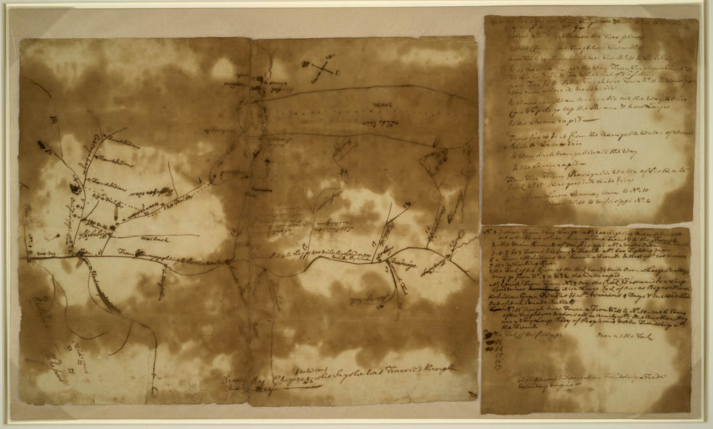
Indian Map of
Ohio River Country
Chegeree (the Indian)
Map of the country about the
Mississippi
[ca. 1755]
Manuscript map
Geography & Map Division
Purchased from Peter Force, 1867 (113.4)
|
According to marginal notations, this rough sketch
map was drawn by "Chegeree (the Indian) who says he has travell'd
through the country." One of the very few examples in the Library's
collection of a map drawn by a Native American, it shows Indian
settlements in the area from Lake Erie to the mouth of the Ohio
river in the middle of the eighteenth century.
|