The Road West
Charles Preuss.
Topographical Map of the
Road from Missouri to Oregon
Commencing at the Mouth of the Kansas in the Missouri river and
ending at the mouth of the Wallah Wallah in the Columbia from the
field notes and journal of Captain J.C. Fremont,
Sheet IV
Baltimore, MD, 1846
Printed map
Geography & Map Division
(38B)
|
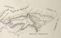
During the 1840s and early 1850s, John C. Fremont, a noted western
explorer renowned for his active role in the conquest of California
during the Mexican War, made four expeditions with his cartographer
Charles Preuss throughout the western United States. Preuss's seven-sheet
map of the two-thousand-mile Oregon Trail was published as a congressional
document in 1846. In this section, the marginalia included Fremont's
observations about the teams climb to the top of Fremont's Peak
at the Western base of the Rocky Mountains. Migrants relied heavily
upon this series of maps.
|