

Images and Data
SSEC Data Center
Provides access, maintenance and distribution
of real-time and archive weather and satellite data.
SSEC Galleries
picture galleries: Antarctica / Polar, Field
Experiments, Environment and Weather ...
Real-Time Imagery and Data
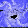 |
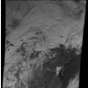
Antarctic images, movies, and weather data Antarctic satellite
images and animations, synoptic weather data, iceberg images,
model data ... (Antarctic Meteorological Research Center) |
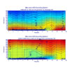 |
Atmospheric Emitted Radiance Interferometer (AERI) Ground-based remote
sensing of temperature and water vapor profiles, sea surface
temperature/emissivities, cloud properties ... |
 |
CIMSS Regional Assimilation System Forecast (CRAS) Forecasts of various
atmospheric parameters, including forecasted satellite images. |
 |
CLAVR-x Near Real-Time ResultsDiagnostic looks of the
non-operational STAR CLAVR-x
system |
 |
Convective Initiation Assessment Products Products designed to
monitor the initial development and evolution of convective
storms over land and oceans. |
 |
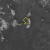
Fire monitoring satellite images Automated Biomass Burning
Algorithm (ABBA) GOES satellite images of fires occuring in
the western hemisphere (North and South America) |
 |
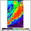
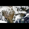
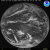
Geostationary weather satellite imagesGOES (North and South
America), Meteosat (Europe and Africa) , MTSAT (Asia and Australia) |
 |
Geostationary Satellite Image Browser Web page interface for
viewing GOES, MTSAT, and Meteosat satellite pictures and movies
in multiple image channels and more |
 |
Global Satellite Data Collaborations View, mark-up and discuss
GOES, MTSAT, Meteosat, and Derived Products images with other
people via this web-based, Java interface. |
 |
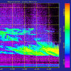
GOES Derived Products Precipitable Water,
Lifted Index/CAPE, Cloud Top Pressure, Ozone, Sea-Surface Temperature,
... |
 |
GOES US Full Resolution Visible Image BrowserFull resolution, real-time
GOES East/West composite satellite image web page interface
with zoom and animation features |
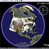 |
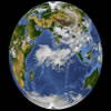
Google Earth ImageryReal-time satellite imagery
(AVHRR, MODIS ...) provided in Google Earth format. |
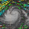 |
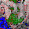
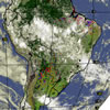
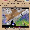
Hurricane and tropical storm images Satellite images and
derived parameters (winds, vorticity ...) focusing on hurricanes
and tropical storms |
 |
IDEA: Infusing satellite Data into Environmental Applications air quality analysis
/ forecasting data and images |
 |
Kalpana Image and Navigation Quality TilesKalpana imagery viewer |
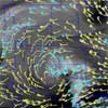 |
Mesoscale winds Upper level wind analysis
from GOES water vapor winds |
 |
MODIS Today Real time MODIS imagery
accessible via web browser and Google Earth |
 |
PDA Animated Weather (PAW) PAW is a PDA friendly
weather web site that contains real-time images, graphics and
text formated for display on PDA devices equiped with high
resolution color displays. |
 |
Polar orbiting weather satellite images Continental U.S. Terra/Aqua MODIS pictures
and movies |
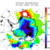 |
Real-Time Polar Remote Sensing Products Plots of near real-time
surface, cloud, and radiative properties over the Arctic and
Antarctic, using AVHRR satellite data and the CASPR software
package |
 |
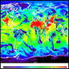
Satellite composite images including the SSEC Global
Montage, Rotating Globe movie, and Antarctic composite |
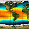 |
Sea Surface Temperature Satellite derived sea
surface temperatures. |
 |
SOSE Real-time satellite image viewerView real-time satellite data around the world. |
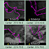
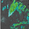
Storm Tracker Analysis Tool and Archive An interactive tool
for tracking convective clusters from satellite and radar data |
|
 |
Volcano watch Satellite pictures covering
the top ten active volcanoes from around the world |
 |
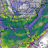
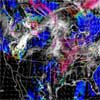
Wisconsin and Midwest Weather Weather observations,
forecasts, meteograms, radar ... |
Other Data and Resources
 |
NOAAPORT provides access to NOAA's
real-time environmental data and products |
 |
SSEC Data Center Archive Archive of geostationary
satellite data and NOAAPORT point, grid, and text weather data |
 |
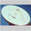
University of Wisconsin-Madison Lidar Group Active remote sensing
of atmospheric profiles using a ground-based laser. |
| CIMSS
Satellite Blog A weblog of meteorological satellite imagery
relevant to current weather events |
