|
|
|
Metadata
|
|
ID
|
S-1-76-EG
|
|
Also Known As
|
SEA176EG
|
|
Abstract
|
Chief Scientists: Bruce Molnia, Paul Carlson. Geophysical
data (3dot5khz, sparker, LoranA, miniranger, radar, dartcore,
gravitycore, pistoncore, Shipekgrab, VanVeengrab,
underwatertelevision, underwatercamera, sidescansonar,
transitsatellite, uniboom) of field activity S-1-76-EG in
Eastern Gulf of Alaska from 06/06/1976 to 06/16/1976
|
|
Chief Scientist
|
Bruce Molnia
Paul Carlson
|
|
Activity Type
|
Geophysical
|
|
Platform
|
Sea Sounder
|
|
Area of Operation
|
Eastern Gulf of Alaska
|
|
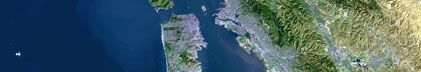
Location map
|

|
|
Bounding Coordinates
|
60.21967
-149.38055 -135.51442
57.22627
|
|
Ports
|
leave Sitka, AK
arrive Seward, AK
|
|
Dates
|
06/06/1976 (JD 158) to 06/16/1976 (JD 168)
|
|
Analog Materials
|
list
|
|
Index map

|
|
|
Crew
|
|
Al McClenaghan
|
Ship Captain
|
|
Andy Alden
|
Watchstander, USGS Western Region
|
|
Austin Post
|
Geologist, USGS Western Region
|
|
Bruce Molnia
|
Chief Scientist, USGS Western Region
|
|
Darlene Condra
|
Navigator, USGS Western Region
|
|
Dennis Kerr
|
Watchstander, USGS Western Region
|
|
Don Phillips
|
Chief Engineer, USGS Western Region
|
|
Elias Zendejas
|
Watchstander, USGS Western Region
|
|
George Redden
|
Watchstander, USGS Western Region
|
|
Glen Schumacher
|
Navigator, USGS Western Region
|
|
Harry Hill
|
Electronics Technician, USGS Western Region
|
|
Jack Hampson
|
Watchstander, USGS Western Region
|
|
John Cudnohufsky
|
Watchstander, USGS Western Region
|
|
Kelly Mitchell
|
Chief Mate, USGS Western Region
|
|
Paul Fuller
|
Dafe Curator, USGS Western Region
|
|
Paula Quinterno
|
Geologist, USGS Western Region
|
|
Rich Garlow
|
Navigator, USGS Western Region
|
|
Steve Kittleson
|
Watchstander, USGS Western Region
|
|
Steve Wallace
|
Watchstander, USGS Western Region
|
|
Paul Carlson
|
Chief Scientist, USGS Western Region
|
|
|
Equipment Used
|
|
3dot5khz
|
|
sparker
|
|
LoranA
|
|
miniranger
|
|
radar
|
|
dartcore
|
|
gravitycore
|
|
pistoncore
|
|
Shipekgrab
|
|
VanVeengrab
|
|
underwatertelevision
|
|
underwatercamera
|
|
sidescansonar
|
|
transitsatellite
|
|
uniboom
|
|
|
NGDC Overview
|
|
! Converted to time format with year at start.
|
|
!
|
|
DATA COLLECTION OVERVIEW (use NGDC GEODAS CD to retrieve data)
|
|
|
|
MCG Data Collection ID --- S176EG
|
|
Institution Data Collection ID --- S176EG
|
|
NGDC ID --- 06110044
|
|
Funding --- (unspecified)
|
|
Project, Cruise & Leg --- SEA176EG Paul Carlson
|
|
Study region --- +61.00000,+57.00000,-150.00000,-135.00000
|
|
Chief Scientist(s) --- Bruce Molnia
|
|
Name of vessel --- Sea Sounder (surface ship)
|
|
Date field data collection started --- 06/05/76 LV SITKA, AK
|
|
Date field data collection ended --- 06/16/76 AR SEWARD, AK
|
|
Parameters surveyed ---
|
|
Bathymetry: surveyed, contained in data file
|
|
Magnetics: (unspecified)
|
|
Gravity: (unspecified)
|
|
High-resolution seismics: (unspecified)
|
|
Deep penetration seismics: (unspecified)
|
|
Format --- (I1,A8,F5.2,4I2,F5.3,F8.5,F9.5,I1,F6.4,F6.1,I2,i1,3F6.1,I1,F5.1,F6.0,F7.1,F6.1,F5.1,A8,4I1)
|
|
Date of data input to NGDC --- 11/30/90
|
|
Contributing institution --- USGS Branch of Pacific Marine Geology
|
|
Country --- United States
|
|
|
|
Navigation instrumentation --- NAV-SAT LORAN A MINIRANGER RADAR D.R.
|
|
Position determination method --- (unspecified)
|
|
|
|
Bathymetry instrumentation --- 3.5KH BATHY
|
|
Additional forms of bathymetric data --- (unspecified)
|
|
General rate of bathymetry in file --- 1.7 minutes
|
|
General collection rate of bathymetry --- (unspecified)
|
|
Assumed sound velocity --- 1463.0 m/sec
|
|
Bathymetric datum code --- No correction applied (sea level)
|
|
Bathmetry interpolation scheme --- (unspecified)
|
|
|
|
Magnetics instrumentation --- (unspecified)
|
|
Additional forms of magnetics data --- (unspecified)
|
|
General rate of magnetics in file --- (unspecified)
|
|
General collection rate of magnetics --- (unspecified)
|
|
Magnetic sensor tow distance --- (unspecified)
|
|
Magnetic sensor depth --- (unspecified)
|
|
Two sensor horizontal separation --- (unspecified)
|
|
Residual magnetics reference field --- (unspecified)
|
|
Method of applying residual field --- (unspecified)
|
|
|
|
Gravity instrumentation --- (unspecified)
|
|
Additional forms of gravity data --- (unspecified)
|
|
General rate of gravity in file --- (unspecified)
|
|
General collection rate of gravity --- (unspecified)
|
|
Theoretical gravity formula --- (unspecified)
|
|
Reference system --- (unspecified)
|
|
Corrections applied --- (unspecified)
|
|
Starting land tie --- (unspecified)
|
|
Ending land tie --- (unspecified)
|
|
|
|
Seismic instrumentation --- SPARKER
|
|
Formats of seismic data --- (unspecified)
|
|
|
Publications
|
|
Kvenvolden, K.A., Redden, G.D., and Carlson, P.R., 1977, Hydrocarbon gases in sediments
|
|
of eastern Gulf of Alaska: American Association of Petroleum Geologists Bulletin, v. 61,
|
no. 5, p. 806.
|
|
|
Bruns, T.R., Carlson, P.R., and Schwab, W.C., 1977, Listric faults south of Kayak Island,
|
|
northern Gulf of Alaska: Geological Society of America Abstracts with Programs, v. 9, no. 7,
|
p. 914.
|
|
|
Carlson, P.R., Bruns, T.R., Molnia, B., and Hampson, J.C., Jr., 1977, Submarine valleys on
|
|
the continental shelf, northeastern Gulf of Alaska: Geological Society of America Abstracts
|
with Programs, v. 9, no. 7, p. 921.
|
|
|
Carlson, P.R., and Molnia, B.F., 1977, Submarine faults and slides on the continental shelf,
|
|
northern Gulf of Alaska, in Richards, A.F., ed., Marine slope stability: Marine Geotechnology,
|
v. 2, p. 275-290.
|
|
|
Carlson, P.R., Molnia, B.F., Kittelson, S.C., and Hampson, J.C., Jr., 1977,
|
|
Map of distribution of bottom sediments on the continental shelf, northern Gulf of Alaska:
|
U.S. Geological Survey Miscellaneous Field Studies Map MF-0876.
|
|
|
Molnia, B.F., and Carlson, P.R., 1978, Surface sedimentary units of northern Gulf of Alaska
|
continental shelf: American Association of Petroleum Geologists Bulletin, v. 62, no. 4, p. 633-643.
|
|
|
Carlson P.R., and Molnia, B.F., 1977, Faulting, instability, erosion, and deposition of shelf
|
|
sediments, eastern Gulf of Alaska, in Environmental assessment of the Alaskan continental
|
shelf; Hazards: Boulder, CO, U.S. Department of Commerce Environmental Resource Laboratories.
|
|
|
Molnia, B.F., Carlson, P.R., and Levy, W.P., 1978, Holocene sediment volume and modern
|
|
sediment yield, Northeast Gulf of Alaska: American Association of Petroleum Geologists
|
Bulletin, v. 62, no. 3, p. 545.
|
|
|
Plafker, G., Bruns, T.R., Carlson, P.R., Molnia, B.F., Scott, E.W., Kahler, R., and
|
|
Wilson, C., 1978, Petroleum potential, geologic hazards, and technology for exploration in
|
|
the outer continental shelf of the Gulf of Alaska Tertiary province: U.S. Geological Survey
|
Open-File Report 78-490, 50 p.
|
|
|
Molnia, B.F., Kvenvolden, K.A., Redden, G.D., Carlson, P.R., Bruns, T.R., Molnia, B.F.,
|
|
Hampson, J.C., Jr., and Schwab, W.C., 1978, Environmental geologic studies, northeastern
|
Gulf of Alaska: U.S. Geological Survey Professional Paper 1100, p. 153-155.
|
|
|
Carlson, P.R., Molnia, B.F., and Quinterno, P., 1978, Transport of inner shelf sediment into
|
|
glacially scoured troughs, northeastern Gulf of Alaska: American Geophysical Union Eos,
|
Transactions, v. 59, no. 12, p. 1109.
|
|
|
Molnia, B.F., Carlson, P.R., and Kvenvolden, K.A., 1978, Gas-charged sediment areas in the
|
|
northern Gulf of Alaska: Geological Society of America Abstracts with Programs, v. 10, no. 7,
|
p. 458-459.
|
|
|
Hampton, M.A., Bouma, A.H., Carlson, P.R., Molnia, B.F., Clukey, E.C., and Sangrey, D.A.,
|
|
1978, Quantitative study of slope instability in the Gulf of Alaska: Offshore Technology
|
Conference Proceedings, no. 10, v. 4, p. 2307-2318.
|
|
|
Molnia, B.F., Carlson, P.R., and Levy, W.P., 1979, Holocene sediment volume on the northeast Gulf of
|
|
Alaska Continental Shelf and the sediment contribution of present-day rivers: U.S. Geological Survey
|
Professional Paper 1150, p. 151-152.
|
|
|
Molnia, B.F., Carlson, P.R., and Kvenvolden, K.A., 1979, Gas-charged sediment areas in the
|
northern Gulf of Alaska: U.S. Geological Survey Professional Paper 1150, p. 152-153.
|
|
Carlson, P.R., Molnia, B.F., and Levy, W.P., 1980, Continuous acoustic profiles and sedimentologic
|
|
data from R/V Sea Sounder Cruise (S-1-76), eastern Gulf of Alaska: U.S. Geological Survey Open-File
|
Report 80-65, 42 p.
|
|
|
Molnia, B.F., Levy, W.P., and Carlson, P.R., 1980, Map showing Holocene sedimentation rates
|
|
in the northeastern Gulf of Alaska: U.S. Geological Survey Miscellaneous Field Studies Map
|
MF-1170, 1 sheet.
|
|
|
Molnia, B.F., and Carlson, P.R., 1980, Quaternary sedimentary facies on continental shelf,
|
|
Northeast Gulf of Alaska: American Association of Petroleum Geologists Bulletin, v. 64,
|
no. 3, p. 446-447.
|
|
|
Carlson, P.R., Molnia, B.F., and Wheeler, M.C., 1980, Seafloor geologic hazards in OCS lease
|
|
area 55, eastern Gulf of Alaska: Offshore Technology Conference Proceedings, no. 12, v. 4,
|
p. 593-603.
|
|
|
Molnia, B.F., and Carlson, P.R., 1980, Quaternary sedimentary facies of the northeast Gulf
|
of Alaska Continental Shelf: U.S. Geological Survey Professional Paper 1175, p. 158-159.
|
|
|
Quinterno, Paula J., Carlson, Paul R., and Molnia, Bruce F., 1981, Benthic foraminifers as
|
|
indicators of the Pleistocene-Holocene boundary in the eastern Gulf of Alaska, in Albert,
|
|
N.R., and Hudson, Travis, eds., The United States Geological Survey in Alaska; accomplishments
|
during 1979: U.S. Geological Survey Circular 0823-B, p. 128-131.
|
|
|
Molnia, Bruce F., Post, Austin, and Carlson, Paul R., 1996, Glacial-marine acoustic
|
|
stratigraphy in Gulf of Alaska fiords: Geological Society of America Abstracts with
|
Programs, v. 28, no. 7, p. 507.
|
|
|
Got Help?
|
For S-1-76-EG, we would appreciate any information on -- contract, days at sea, dive count, funding, information specialist, information to be derived, kms of navigation, national plan, notes, organization, owner, project, project number, purpose, scanned materials, seismic description, station count, station description, submersible, summary, tabulated info.
|
|