|
Hispanic Division: Back to Portuguese Role in Exploring and Mapping the New World
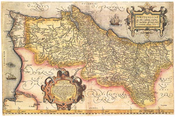
Portugal during the Age of DiscoveriesThe small kingdom of Portugal, strategically located on the southwestern portion of the Iberian Peninsula facing the Atlantic Ocean, is delineated on this beautifully engraved, hand-colored map. Based on the first known map of Portugal, published about 1561 by Fernando Álvares Seco, this version appeared in the numerous editions of the first modern atlas, Theatrum Orbis Terrarum, originally published in 1570 by the noted Flemish cartographer Abraham Ortelius. This cartographic representation portrays the geographical features of the kingdom at the height of its prosperity and prestige during the Age of Discoveries. The map is adorned with drawings of two ships, suggesting the Portuguese caravel, a small but fast vessel which contributed greatly to Portugal's early dominance in maritime exploration.
101 Independence Ave. SE Washington, D.C. 20540 |
SELECT FROM THE FOLLOWING: Portugal during the Age of Discoveries The First Circumnavigation of the Globe Portuguese Exploration along the Northeast Coast of North America Cabrilho's Discovery of California Portuguese View of the World at the Beginning of the Seventeenth Century
|