|
|
|
Metadata
|
|
ID
|
P-1-68-SC
|
|
Abstract
|
United States Geological Survey, Menlo Park, California.
Chief Scientist: Gene Rusnak. Geophysical data (sparker,
bathymetry) of field activity P-1-68-SC in Santa Barbara
Channel to Pt. Conception, Southern California from
06/14/1968 to 07/11/1968
|
|
Organization
|
United States Geological Survey, Menlo Park, California
|
|
Project/Theme
|
Conception Cruise
|
|
Chief Scientist
|
Gene Rusnak
|
|
Activity Type
|
Geophysical
|
|
Platform
|
Polaris I
|
|
Area of Operation
|
Santa Barbara Channel to Pt. Conception, Southern California
|
|
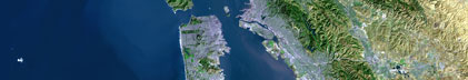
Location map
|

|
|
Bounding Coordinates
|
34.75000
-122.75000 -116.75000
32.25000
|
|
Dates
|
06/14/1968 (JD 166) to 07/11/1968 (JD 193)
|
|
Analog Materials
|
list
|
|
Index map

|
|
|
Information Specialist
|
|
|
Crew
|
|
Gene Rusnak
|
Chief Scientist, USGS Western Region
|
|
Steve Wolf
|
Scientist, USGS Western Region
|
|
|
Equipment Used
|
|
|
Purpose
|
|
To substantiate earlier work showing how the thick sediments of the
|
|
Santa Barbara Channel thin out and abut against older crystalline or meta-
|
|
sedimentary rocks of the Channel Islands.
|
|
|
Information to be Derived
|
|
Bathymetry, seismic reflection profiles, geologic map.
|
|
|
Got Help?
|
For P-1-68-SC, we would appreciate any information on -- contract, days at sea, dive count, funding, kms of navigation, national plan, NGDC Info, notes, owner, ports, project number, publications, scanned materials, seismic description, station count, station description, submersible, summary, tabulated info.
|
|