|
|
|
Metadata
|
|
ID
|
K-1-81-HW
|
|
Abstract
|
Chief Scientist: Bill Normark. Geological and Geophysical
data (gravitycore, chaindredge, 3dot5khz, 12khz, minisparker,
miniranger) of field activity K-1-81-HW in Hawaii from
01/26/1981 to 02/05/1981
|
|
Chief Scientist
|
Bill Normark
|
|
Activity Type
|
Geological and Geophysical
|
|
Platform
|
Kana Keoki
|
|
Area of Operation
|
Hawaii
|
|
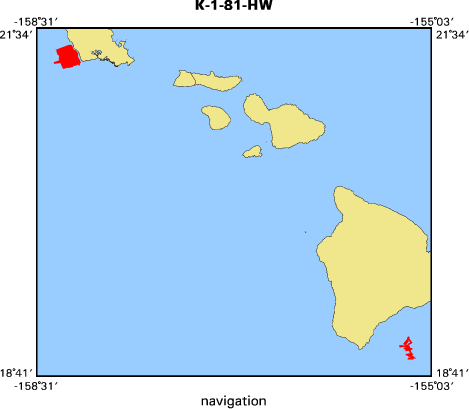
Location map
|

|
|
Bounding Coordinates
|
21.42463
-158.35316 -155.20305
18.83609
|
|
Ports
|
leave Honolulu, HI
arrive Honolulu, HI
leave Kanaihae, HI
arrive Kanaihae, HI
|
|
Dates
|
01/26/1981 (JD 026) to 02/05/1981 (JD 036)
|
|
Analog Materials
|
list
|
|
Index map
|
|
|
Crew
|
|
Barbara Seekins
|
Navigator
|
|
Bill Clark
|
Chief Engineer
|
|
Bill King
|
Ship Captain
|
|
Bill Normark
|
Chief Scientist, USGS Western Region
|
|
Bob Patrick
|
Electronics Technician, USGS Western Region
|
|
Chris Gutmacher
|
Navigator, USGS Western Region
|
|
Dave Clague
|
Geologist, USGS Western Region
|
|
Jim Moore
|
Geologist, USGS Western Region
|
|
John Stahl
|
Chief Mate, USGS Western Region
|
|
Kaye Kinoshita
|
Navigator, USGS Western Region
|
|
Mary Hunt
|
Geologist, USGS Western Region
|
|
Pat Wilde
|
Geologist, USGS Western Region
|
|
Tom Chase
|
Geologist, USGS Western Region
|
|
|
Equipment Used
|
|
gravitycore
|
|
chaindredge
|
|
3dot5khz
|
|
12khz
|
|
minisparker
|
|
miniranger
|
|
|
NGDC Overview
|
|
! Converted to time format with year at start.
|
|
!
|
|
DATA COLLECTION OVERVIEW (use NGDC GEODAS CD to retrieve data)
|
|
|
|
MCG Data Collection ID --- K181HW
|
|
Institution Data Collection ID --- K181HW
|
|
NGDC ID --- 06100004
|
|
Funding --- (unspecified)
|
|
Project, Cruise & Leg --- (unspecified)
|
|
Study region --- +22.00000,+18.00000,-159.00000,-155.00000
|
|
Chief Scientist(s) --- Bill Normark
|
|
Name of vessel --- Kana Keoki (surface ship)
|
|
Date field data collection started --- 01/26/81 LEAVE HONOLULU
|
|
Date field data collection ended --- 02/05/81 ARRIVE HONOLULU
|
|
Parameters surveyed ---
|
|
Bathymetry: surveyed, contained in data file
|
|
Magnetics: (unspecified)
|
|
Gravity: (unspecified)
|
|
High-resolution seismics: (unspecified)
|
|
Deep penetration seismics: (unspecified)
|
|
Format --- (I1,A8,F5.2,4I2,F5.3,F8.5,F9.5,I1,F6.4,F6.1,I2,i1,3F6.1,I1,F5.1,F6.0,F7.1,F6.1,F5.1,A8,4I1)
|
|
Date of data input to NGDC --- 11/30/90
|
|
Contributing institution --- USGS Branch of Pacific Marine Geology
|
|
Country --- United States
|
|
|
|
Navigation instrumentation --- (unspecified)
|
|
Position determination method --- (unspecified)
|
|
|
|
Bathymetry instrumentation --- (unspecified)
|
|
Additional forms of bathymetric data --- (unspecified)
|
|
General rate of bathymetry in file --- 1.1 minutes
|
|
General collection rate of bathymetry --- (unspecified)
|
|
Assumed sound velocity --- 1463.0 m/sec
|
|
Bathymetric datum code --- No correction applied (sea level)
|
|
Bathmetry interpolation scheme --- (unspecified)
|
|
|
|
Magnetics instrumentation --- (unspecified)
|
|
Additional forms of magnetics data --- (unspecified)
|
|
General rate of magnetics in file --- (unspecified)
|
|
General collection rate of magnetics --- (unspecified)
|
|
Magnetic sensor tow distance --- (unspecified)
|
|
Magnetic sensor depth --- (unspecified)
|
|
Two sensor horizontal separation --- (unspecified)
|
|
Residual magnetics reference field --- (unspecified)
|
|
Method of applying residual field --- (unspecified)
|
|
|
|
Gravity instrumentation --- (unspecified)
|
|
Additional forms of gravity data --- (unspecified)
|
|
General rate of gravity in file --- (unspecified)
|
|
General collection rate of gravity --- (unspecified)
|
|
Theoretical gravity formula --- (unspecified)
|
|
Reference system --- (unspecified)
|
|
Corrections applied --- (unspecified)
|
|
Starting land tie --- (unspecified)
|
|
Ending land tie --- (unspecified)
|
|
|
|
Seismic instrumentation --- (unspecified)
|
|
Formats of seismic data --- (unspecified)
|
|
|
Publications
|
|
Moore, J.G., Clague, D.A., and Normark, W.R., 1982, Diverse basalt types from Loihi Seamount,
|
Hawaii: Boulder, CO, Geology, v. 10, no. 2, p. 88-92.
|
|
|
Alpha, T.R., Morley, J.M., Gutmacher, C.E., and Austin, W.A., 1982, Oblique map of Loihi
|
|
Seamount and Papa'u Landslide, Hawaii: U.S. Geological Survey Open-File Report 82-0463,
|
1 sheet.
|
|
|
Normark, W.R., Chase, T.E., Wilde, Pat, Hampton, M.A., Gutmacher, C.E., Seekins, B.A.,
|
|
and Johnson, K.H., 1982, Geologic report for the O'OTEC site off Kahe Point, Oahu, Hawaii:
|
U.S. Geological Survey Open-File Report 82-0468-A, 9 p.
|
|
|
Normark, W.R., Chase, T.E., Wilde, Pat, Hampton, M.A., Gutmacher, C.E., Seekins, B.A.,
|
|
and Johnson, K.H., 1982, Geologic report for the O'OTEC site off Kahe Point, Oahu, Hawaii:
|
U.S. Geological Survey Open-File Report 82-0468-C, 1 roll.
|
|
|
Normark, William R., Clague, David A., and Moore, James G., 1982, The next island: Natural
|
History, v. 91, no. 12, p. 68-71.
|
|
|
Clague, David, Moore, J.G., and Normark, W.R., 1983, Petrology of Loihi Seamount, Hawaii:
|
U.S. Geological Survey Professional Paper 1375, p. 110.
|
|
|
Clague, D.A., Moore, J.G., and Normark, William R., 1981, Loihi Seamount; early alkalic
|
|
eruptive phase, in American Geophysical Union; 1981 fall meeting: American Geophysical
|
Union Eos, Transactions, v. 62, no. 45, p. 1082.
|
|
|
Dengler, A.T., Wilde, P., Noda, E.K., and Normark, William R., 1983, Turbidity currents generated
|
|
by Hurricane Iwa: The Geological Society of America, 96th annual meeting: Geological Society of
|
America Abstracts with Programs, v. 15, no. 6, p. 556.
|
|
|
Dengler, A.T., Wilde, P., Noda, E.K., and Normark, W.R., 1984, Turbidity currents generated
|
by Hurricane Iwa: Geo-Marine Letters, v. 4, no. 1, p. 5-11.
|
|
|
Quinby-Hunt, M.S., Wilde, Pat, Corrigan, D., Dengler, A.T., and Normark, William R.,
|
|
1986, Very recent analogs of volcanogenic Archean sequences: Boulder, CO, Geology, v. 14,
|
no. 1, p. 48-51.
|
|
|
Normark, W.R., Wilde, Pat, Campbell, J.F., Chase, T.E., and Tsutsui, Bruce, 1993,
|
|
Submarine slope failures initiated by Hurricane Iwa, Kahe Point, Oahu, Hawaii,
|
|
in Schwab, W.C., Lee, H.J., Twichell, D.C., eds., Submarine landslides; selected
|
|
studies in the U.S. Exclusive Economic Zone: U.S. Geological Survey Bulletin 2002,
|
p. 197-204.
|
|
|
Got Help?
|
For K-1-81-HW, we would appreciate any information on -- contract, days at sea, dive count, funding, information specialist, information to be derived, kms of navigation, national plan, notes, organization, owner, project, project number, purpose, scanned materials, seismic description, station count, station description, submersible, summary, tabulated info.
|
|


