|
|
|
Metadata
|
|
ID
|
S-12-78-NC
|
|
Abstract
|
Chief Scientists: Mike Field, Sam Clarke. Geological and
Geophysical data (integratednavigation, RhoRho, miniranger,
transitsatellite, 3dot5khz, magnetics, tempsalinometer,
gravitycore, uniboom, airgun, sparker) of field activity
S-12-78-NC in Coos Bay, Oregon from 11/02/1978 to 11/12/1978
|
|
Chief Scientist
|
Mike Field
Sam Clarke
|
|
Activity Type
|
Geological and Geophysical
|
|
Platform
|
Sea Sounder
|
|
Area of Operation
|
Coos Bay, Oregon
|
|
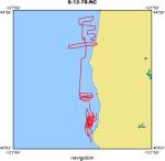
Location map
|
|
|
Bounding Coordinates
|
44.27508
-125.44217 -124.21708
40.24013
|
|
Ports
|
leave Coos Bay, OR
arrive Redwood City (Approx.), CA
|
|
Dates
|
11/02/1978 (JD 306) to 11/12/1978 (JD 316)
|
|
Analog Materials
|
list
|
|
Index map

|
|
|
Crew
|
|
Bill Richmond
|
Geologist, USGS Western Region
|
|
Bob Patrick
|
Electronics Technician, USGS Western Region
|
|
Brian Edwards
|
Geologist, USGS Western Region
|
|
Carol Hirozawa
|
Navigator, USGS Western Region
|
|
Carol Madison
|
Dafe Curator, USGS Western Region
|
|
Florence Wong
|
Geologist, USGS Western Region
|
|
Garey Simpson
|
Geologist, USGS Western Region
|
|
Gary Hill
|
Biologist, USGS Western Region
|
|
George Tate
|
Geologist, USGS Western Region
|
|
Graig McHendrie
|
Navigator, USGS Western Region
|
|
John Chin
|
Geologist, USGS Western Region
|
|
John Laingor
|
Chief Mate, USGS Western Region
|
|
John Saladin
|
Electronics Technician, USGS Western Region
|
|
Ken Taylor
|
Chief Engineer, USGS Western Region
|
|
Kevin O'Toole
|
Mechanical Technician, USGS Western Region
|
|
Margaret Goud
|
Navigator, USGS Western Region
|
|
Mike Field
|
Chief Scientist, USGS Western Region
|
|
Richard Heagney
|
Ship Captain
|
|
Sam Clarke
|
Chief Scientist, USGS Western Region
|
|
|
Equipment Used
|
|
integratednavigation
|
|
RhoRho
|
|
miniranger
|
|
transitsatellite
|
|
3dot5khz
|
|
magnetics
|
|
tempsalinometer
|
|
gravitycore
|
|
uniboom
|
|
airgun
|
|
sparker
|
|
|
Notes
|
|
Although these have an NC (Northern California) suffix on the cruise
|
|
year, they are all from Oregon - Sam Clarke.
|
|
|
Publications
|
|
Reid, J.A., Reid, J.M., Jenkins, C.J., Zimmermann, M., Williams, S.J., and
|
|
Field, M.E., 2006, usSEABED: Pacific Coast (California, Oregon, Washington)
|
|
offshore surficial-sediment data release, U.S. Geological Survey Data Series
|
|
182, version 1.0. Online at:
|
|
|
http://pubs.usgs.gov/ds/2006/182/
|
|
|
Wong, Florence L., 1995, Sediment distribution on a stream-dominated continental margin,
|
|
Northern California; implications from heavy-mineral studies: U.S. Geological Survey Open-File
|
Report 95-0614, 21 p.
|
|
|
Got Help?
|
For S-12-78-NC, we would appreciate any information on -- contract, days at sea, dive count, funding, information specialist, information to be derived, kms of navigation, national plan, NGDC Info, organization, owner, project, project number, purpose, scanned materials, seismic description, station count, station description, submersible, summary, tabulated info.
|
|


