|
|
|
Metadata
|
|
ID
|
K-2-81-AR
|
|
Abstract
|
Chief Scientists: Peter Barnes, Erk Reimnitz. Geological
and Geophysical data (uniboom, sidescansonar, DelNortenav,
VanVeengrab, 200khz7khz) of field activity K-2-81-AR in
Arctic from 08/04/1981 to 08/07/1981
|
|
Chief Scientist
|
Peter Barnes
Erk Reimnitz
|
|
Activity Type
|
Geological and Geophysical
|
|
Platform
|
Karluk
|
|
Area of Operation
|
Arctic
|
|
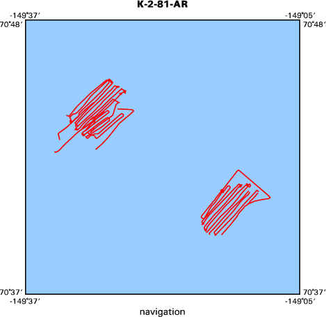
Location map
|

|
|
Bounding Coordinates
|
70.76491
-149.56523 -149.14146
70.66350
|
|
Ports
|
leave Prudhoe Bay, AK
arrive Barrow, AK
|
|
Dates
|
08/04/1981 (JD 216) to 08/07/1981 (JD 219)
|
|
Analog Materials
|
list
|
|
Index map
|
|
|
Crew
|
|
Ed Kempema
|
Geologist
|
|
Peter Barnes
|
Chief Scientist, USGS Western Region
|
|
Erk Reimnitz
|
Chief Scientist, USGS Western Region
|
|
Mike Boyle
|
Electronics Technician, USGS Western Region
|
|
Tom Reiss
|
Geologist, USGS Western Region
|
|
|
Equipment Used
|
|
uniboom
|
|
sidescansonar
|
|
DelNortenav
|
|
VanVeengrab
|
|
200khz7khz
|
|
|
Notes
|
|
dates for samples later than end of navigation by several days -- Clint Steele 8/21/2002
|
|
|
NGDC Overview
|
|
! Converted to time format with year at start.
|
|
!
|
|
DATA COLLECTION OVERVIEW (use NGDC GEODAS CD to retrieve data)
|
|
|
|
MCG Data Collection ID --- K281AR
|
|
Institution Data Collection ID --- K281AR
|
|
NGDC ID --- 06120018
|
|
Funding --- U.S.G.S
|
|
Project, Cruise & Leg --- K281AR
|
|
Study region --- +71.00000,+70.00000,-150.00000,-149.00000
|
|
Chief Scientist(s) --- Peter Barnes, Erk Reimnitz
|
|
Name of vessel --- Karluk (surface ship)
|
|
Date field data collection started --- 08/03/81 Prudhoe Bay Alaska
|
|
Date field data collection ended --- 08/15/81 Barrow Alaska
|
|
Parameters surveyed ---
|
|
Bathymetry: surveyed, contained in data file
|
|
Magnetics: not surveyed
|
|
Gravity: not surveyed
|
|
High-resolution seismics: not surveyed
|
|
Deep penetration seismics: not surveyed
|
|
Format --- (I1,A8,F5.2,4I2,F5.3,F8.5,F9.5,I1,F6.4,F6.1,I2,i1,3F6.1,I1,F5.1,F6.0,F7.1,F6.1,F5.1,A8,4I1)
|
|
Date of data input to NGDC --- 03/21/88
|
|
Contributing institution --- USGS Branch of Pacific Marine Geology
|
|
Country --- United States
|
|
|
|
Navigation instrumentation --- Del Norte
|
|
Position determination method --- (unspecified)
|
|
|
|
Bathymetry instrumentation --- 200 + 7KH Bathymetry
|
|
Additional forms of bathymetric data --- Analog records
|
|
General rate of bathymetry in file --- 1.2 minutes
|
|
General collection rate of bathymetry --- (unspecified)
|
|
Assumed sound velocity --- 1500.0 m/sec
|
|
Bathymetric datum code --- No correction applied (sea level)
|
|
Bathmetry interpolation scheme --- Data was digetized from 30 sec to 5 minute intervals
|
|
|
|
Notes ---
|
|
This bathymetry data was hand-digetized in meters from analog records.
|
|
readings.
|
|
|
Got Help?
|
For K-2-81-AR, we would appreciate any information on -- contract, days at sea, dive count, funding, information specialist, information to be derived, kms of navigation, national plan, organization, owner, project, project number, publications, purpose, scanned materials, seismic description, station count, station description, submersible, summary, tabulated info.
|
|


