|
|
|
Metadata
|
|
ID
|
F-8-89-NC
|
|
Also Known As
|
FRNLF8-89-NC
F-8-89-NC
89019
FRNLF8-89-NC
|
|
Abstract
|
United States Geological Survey, Menlo Park, California.
Chief Scientists: Herman Karl, Bill Schwab, John Chin.
Geophysical data (10khz, 3dot5khz, sidescansonar,
sidescansonar, gravity, magnetics, CTDmeter, Geoprobe,
rangerange, GPS, integratednavigation, RhoRho,
Sonatracktransducer, boxcore, guardbuoy) of field activity
F-8-89-NC in Northern California from 07/28/1989 to
08/02/1989
|
|
Organization
|
United States Geological Survey, Menlo Park, California
|
|
Chief Scientist
|
Herman Karl
Bill Schwab
John Chin
|
|
Activity Type
|
Geophysical
|
|
Platform
|
Farnella
|
|
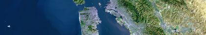
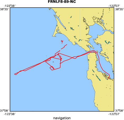
Area of Operation
|
Northern California
|
|
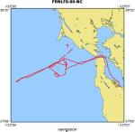
Location map
|
|
|
Bounding Coordinates
|
37.95004
-123.56593 -122.19303
37.50559
|
|
Ports
|
LV REDWOOD CITY
ARRIVE REDWOOD CITY
|
|
Dates
|
07/28/1989 (JD 209) to 08/02/1989 (JD 214)
|
|
Analog Materials
|
list
|
|
Index map
|
|
|
Information Specialist
|
|
|
Crew
|
|
Herman Karl
|
Chief Scientist, USGS Western Region
|
|
Bill Schwab
|
Chief Scientist, USGS Woods Hole
|
|
John Cannan
|
Captain, J. Marr and Sons
|
|
John Chin
|
Co-chief Scientist, USGS Western Region
|
|
Robin Bouse
|
Unspecified, USGS Woods Hole
|
|
Bill Danforth
|
Unspecified, USGS Woods Hole
|
|
Jana DaSilva
|
Unspecified, USGS Woods Hole
|
|
Tom O'Brien
|
Unspecified, USGS Woods Hole
|
|
Michael Hamer
|
Unspecified, USGS Western Region
|
|
Kaye Kinoshita
|
Unspecified, USGS Western Region
|
|
Larry Kooker
|
Unspecified, USGS Western Region
|
|
Mike Torresan
|
Unspecified, USGS Western Region
|
|
Hal Williams
|
Unspecified, USGS Western Region
|
|
Bob Elder
|
Unspecified, DSL WHOI
|
|
Tom Dettweiler
|
Unspecified, Meridian Sciences
|
|
|
Equipment Used
|
|
10khz
|
|
3dot5khz
|
|
sidescansonar
|
|
sidescansonar
|
|
gravity
|
|
magnetics
|
|
CTDmeter
|
|
Geoprobe
|
|
rangerange
|
|
GPS
|
|
integratednavigation
|
|
RhoRho
|
|
Sonatracktransducer
|
|
boxcore
|
|
guardbuoy
|
|
|
Purpose
|
|
Map continental shelf using AMS 120 sidescan sonar and
|
|
Klein 100 kHz sidescan sonar
|
|
|
Publications
|
|
Cruise Report exists at Woods Hole
|
|
|
Got Help?
|
For F-8-89-NC, we would appreciate any information on -- contract, days at sea, dive count, funding, information to be derived, kms of navigation, national plan, NGDC Info, notes, owner, project, project number, scanned materials, seismic description, station count, station description, submersible, summary, tabulated info.
|
|