|
|
|
Metadata
|
|
ID
|
01005
|
|
Also Known As
|
01005
S-2-01-NR
|
|
Abstract
|
United States Geological Survey, Woods Hole, Massachusetts.
Chief Scientist: Rob Thieler. Geological and Geophysical data
(SIS1000, sidescansonar, Geopulse, bathymetry, GPS,
VanVeengrab) of field activity 01005 (S-2-01-NR) in Outer
Banks, North Carolina from 07/01/2001 to 07/19/2001
|
|
Organization
|
United States Geological Survey, Woods Hole, Massachusetts
|
|
Project/Theme
|
Coastal Sedimentary System, Northern North Carolina
|
|
Chief Scientist
|
Rob Thieler
|
|
Activity Type
|
Geological and Geophysical
|
|
Platform
|
Atlantic Surveyor
|
|
Area of Operation
|
Outer Banks, North Carolina
|
|
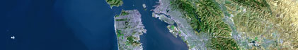
Location map
|

|
|
Bounding Coordinates
|
36.48812
-75.81797 -75.39548
35.70780
|
|
Ports
|
leave Norfolk, VA
arrive Wilmington, NC
|
|
Dates
|
07/01/2001 (JD 182) to 07/19/2001 (JD 200)
|
|
Analog Materials
|
No analog holdings.
|
|
Index map

|
|
|
Information Specialist
|
|
|
Crew
|
|
Rob Thieler
|
Chief Scientist, USGS Woods Hole
|
|
Tom O'Brien
|
Unspecified, USGS Woods Hole
|
|
Dave Nichols
|
Unspecified, USGS Woods Hole
|
|
Barry Irwin
|
Unspecified, USGS Woods Hole
|
|
Jane Denny
|
Unspecified, USGS Woods Hole
|
|
Erika Hammar-Klose
|
Unspecified, USGS Woods Hole
|
|
Bill Danforth
|
Unspecified, USGS Woods Hole
|
|
Mark Capone
|
Mob, USGS Woods Hole
|
|
Chris Polloni
|
Unspecified, USGS Woods Hole
|
|
Kurt Perl
|
Ship Captain, Atlantic Surveyor
|
|
|
Equipment Used
|
|
SIS1000
|
|
sidescansonar
|
|
Geopulse
|
|
bathymetry
|
|
GPS
|
|
VanVeengrab
|
|
|
Purpose
|
|
|
Information to be Derived
|
|
|
Summary
|
|
|
Notes
|
|
Expect to arrive Wilmington no later than 0800 on 19th.
|
|
Navigation techniques: Differential Global Positioning System (DGPS).
|
|
Also used a 100-ft. mudboat.
|
|
|
Publications
|
|
http://www.navcen.uscg.gov/dgps/default.htm
|
|
|
Got Help?
|
For 01005, we would appreciate any information on -- analog materials, contract, days at sea, dive count, funding, kms of navigation, national plan, NGDC Info, owner, project number, scanned materials, seismic description, station count, station description, submersible, tabulated info.
|
|