|
|
|
Metadata
|
|
ID
|
S-B1-99-MB
|
|
Abstract
|
Chief Scientist: Tom Reiss. Geodetic data (geodimeter,
instrumentheightmeter, tripod, battery, stadiarods,
digitalcamera) of field activity S-B1-99-MB in Seabright
Beach, Santa Cruz, CA from 01/13/1999 to 01/13/1999
|
|
Project/Theme
|
Metropolitan Santa Cruz Beach Surveys
|
|
Chief Scientist
|
Tom Reiss
|
|
Activity Type
|
Geodetic
|
|
Platform
|
Unspecified
|
|
Area of Operation
|
Seabright Beach, Santa Cruz, CA
|
|
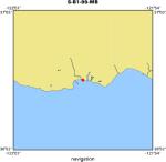
Location map
|
|
|
Bounding Coordinates
|
36.96331
-122.00887 -122.00887
36.96331
|
|
Dates
|
01/13/1999 (JD 013) to 01/13/1999 (JD 013)
|
|
Analog Materials
|
No analog holdings.
|
|
Index map

|
|
|
Crew
|
|
Tom Reiss
|
Chief Scientist, USGS Western Region
|
|
Gretchen Luepke
|
Unspecified, USGS Western Region
|
|
Justin Friesner
|
Unspecified, USGS Western Region
|
|
Kristin Brown
|
Unspecified, U.C. Santa Cruz
|
|
|
Equipment Used
|
|
geodimeter
|
|
instrumentheightmeter
|
|
tripod
|
|
battery
|
|
stadiarods
|
|
digitalcamera
|
|
|
Summary
|
|
A beach and nearshore topographic survey consisting of two shore-normal profiles and one shore-parallel line (wet/dry line) was conducted. The profiles were extended offshore into the surf zone utilizing a swimming rodman.
|
|
|
Notes
|
|
Field Procedure:
|
|
The total station was set up on the sand, seaward of the restrooms
|
|
and shoreward of the berm crest, at Seabright beach. The HA reference
|
|
was set to 000 degree relative to Control Point 10901 "Point". The SECO
|
|
level rods, in conjunction with the level-rod support tripods were
|
|
placed on the control points and pointed towards the total station.
|
|
Program 10 (site setup) was performed on the total station
|
|
Program 20 (station establishment) was performed on the total station
|
|
using option "Unknown Station Location", utilizing Control Points
|
|
10901, 10903, and 10904.
|
|
Program 4 (UTM) was used to collect control and topo points
|
|
Control Points: 10901, 10904, 10902, and 10903 were surveyed (Fast
|
|
Standard mode)
|
|
The Wet/Dry line was surveyed using the EXP3 stadia rod (Tracking
|
|
mode)
|
|
The Profiles were surveyed using the EXP3 stadia rod (Tracking mode)
|
|
and carried offshore into the surf zone. The profiles were carried out
|
|
to the maximum limit of the stadia rod, offshore.
|
|
Gretchen Luepke sketched the beach and assisted with the control
|
|
points.
|
|
Thomas E. Reiss operated the total station and photographed the area.
|
|
Justin Friesner was the rodman
|
|
|
|
Field Observations:
|
|
Well-defined beach cusps were present. Small, shore-break waves
|
|
allowed complete coverage through the surf zone. A broad, flat
|
|
backbeach characterizes this beach. Some wood yet remains from the
|
|
1997-1998 El Nino storms.
|
|
|
Got Help?
|
For S-B1-99-MB, we would appreciate any information on -- analog materials, contract, days at sea, dive count, funding, information specialist, information to be derived, kms of navigation, national plan, NGDC Info, organization, owner, ports, project number, publications, purpose, scanned materials, seismic description, station count, station description, submersible, tabulated info.
|
|


