|
|
|
Metadata
|
|
ID
|
S-1-07-PS
|
|
Abstract
|
United States Geological Survey, Pacific Science
Center,Swinomish Indian Tribal Community, Water Resources
Program. Chief Scientists: Eric Grossman, Sarah Akin.
Sediment Sampling and Submersible Video data (submersible,
VanVeengrab) of field activity S-1-07-PS in Skagit Delta, WA
from 09/17/2007 to 09/22/2007
|
|
Organization
|
United States Geological Survey, Pacific Science Center
Swinomish Indian Tribal Community, Water Resources Program
|
|
Project/Theme
|
Coastal Habitats in Puget Sound
|
|
Chief Scientist
|
Eric Grossman
Sarah Akin
|
|
Activity Type
|
Sediment Sampling and Submersible Video
|
|
Platform
|
Swinomish
|
|
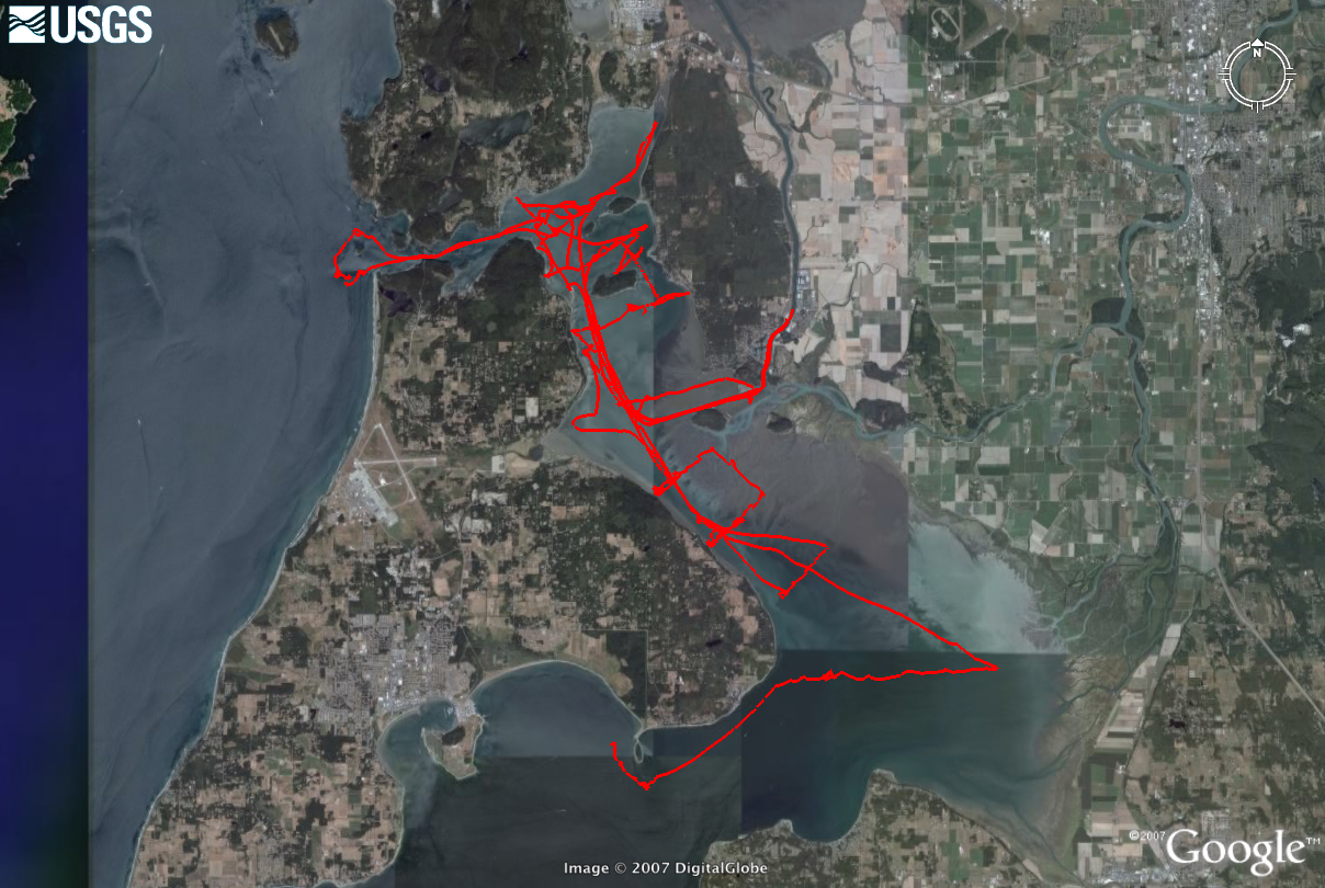
Area of Operation
|
Skagit Delta, WA
|
|
Location map
|

|
|
Bounding Coordinates
|
48.44181
-122.68065 -122.41640
48.26507
|
|
Ports
|
LEAVE La Conner, WA
ARRIVE La Conner, WA
|
|
Dates
|
09/17/2007 (JD 260) to 09/22/2007 (JD 265)
|
|
Analog Materials
|
No analog holdings.
|
|
Index maps

|
|
|
Information Specialist
|
|
|
Crew
|
|
Eric Grossman
|
Chief Scientist, USGS
|
|
Sarah Akin
|
Co-Chief Scientist, Swinomish Tribal Community, Water Resources Program
|
|
Eric Haskins
|
Information Specialist , Swinomish Tribal Community, Water Resources Program
|
|
|
Equipment Used
|
|
|
Purpose
|
|
Determine seafloor substrates and habitats of northern Skagit Bay; ground-truth
|
|
sonar data collected as part of K-1-07-PS (see link below).
|
|
|
Information to be Derived
|
|
video of seafloor morphology, substrate and vegetation type to interpret and
|
|
classify benthic habitats.
|
|
|
Notes
|
|
|
Got Help?
|
For S-1-07-PS, we would appreciate any information on -- analog materials, contract, days at sea, dive count, funding, kms of navigation, national plan, NGDC Info, owner, project number, publications, scanned materials, seismic description, station count, station description, submersible, summary, tabulated info.
|
|