|
|
|
Metadata
|
|
ID
|
K-2-05-PS
|
|
Abstract
|
United States Geological Survey, Menlo Park, California.
Chief Scientist: Eric Grossman. Geological and Geophysical
data (SWATH plus interferometer sonar and EdgeTech 512i,
CHIRP seismic reflection profiler.) of field activity
K-2-05-PS in Skagit Bay, Skagit County, WA from 04/02/2005 to
04/09/2005
|
|
Organization
|
United States Geological Survey, Menlo Park, California
|
|
Project/Theme
|
Coastal Habitats in Puget Sound
|
|
Chief Scientist
|
Eric Grossman
|
|
Activity Type
|
Geological and Geophysical
|
|
Platform
|
Karluk
|
|
Area of Operation
|
Skagit Bay, Skagit County, WA
|
|
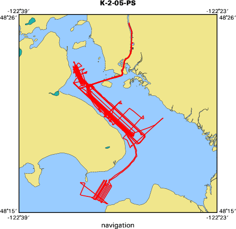
Location map
|

|
|
Bounding Coordinates
|
48.41903
-122.57806 -122.45311
48.25188
|
|
Ports
|
LEAVE La Conner, WA
ARRIVE La Conner, WA
|
|
Dates
|
04/02/2005 (JD 092) to 04/09/2005 (JD 099)
|
|
Analog Materials
|
No analog holdings.
|
|
Index map
|
|
|
Information Specialist
|
|
|
Crew
|
|
Eric Grossman
|
|
Larry Kooker
|
|
Dave Hogg
|
|
Byron Richards
|
|
|
Equipment Used
|
|
SWATH plus interferometer
|
|
CHIRP seismic reflection
|
(profiler.)
|
|
|
Purpose
|
|
Map seafloor habitat and substrate types and subsurface facies
|
|
|
Information to be Derived
|
|
Seafloor bathymetry and backscatter; Subsurface facies and sediment thickness
|
|
|
Summary
|
|
Approximately 230 km of bathymetry and backscatter and 90 km of CHIRP
|
|
seismic reflection data collected from four areas within Skagit Bay and the Swinomish Channel of Skagit County
|
|
|
|
|
|
Got Help?
|
For K-2-05-PS, we would appreciate any information on -- analog materials, contract, days at sea, dive count, funding, kms of navigation, national plan, NGDC Info, owner, project number, scanned materials, seismic description, station count, station description, submersible, tabulated info.
|


