|
|
|
Metadata
|
|
ID
|
B-2-06-PS
|
|
Abstract
|
United States Geological Survey, Pacific Science Center.
Chief Scientist: Eric Grossman:. ADCP and CTD data (ADCP,
CTD) of field activity B-2-06-PS in Skagit Bay from
06/12/2006 to 06/16/2006
|
|
Organization
|
United States Geological Survey, Pacific Science Center
|
|
Project/Theme
|
Coastal Habitats in Puget Sound
|
|
Chief Scientist
|
Eric Grossman:
|
|
Activity Type
|
ADCP and CTD
|
|
Platform
|
21-ft Gregor
|
|
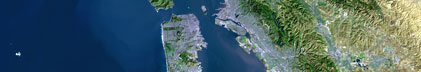
Area of Operation
|
Skagit Bay
|
|
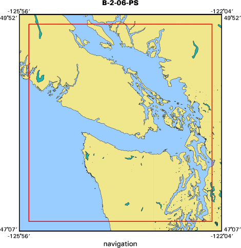
Location map
|

|
|
Bounding Coordinates
|
49.75000
-125.75000 -122.25000
47.25000
|
|
Ports
|
LEAVE La Conner, Washington
ARRIVE La Conner, Washington
|
|
Dates
|
06/12/2006 (JD 163) to 06/16/2006 (JD 167)
|
|
Analog Materials
|
No analog holdings.
|
|
Index map
|
|
|
Information Specialist
|
|
|
Crew
|
|
Eric Grossman
|
Chief Scientist, USGS/CMG
|
|
Andrew Stevens
|
Information Specialist, USGS/CMG
|
|
Anthony Paulson
|
Scientist, USGS/WRD
|
|
Chris Curran
|
Scientist, USGS/WRD
|
|
Greg Hood
|
Scientist, Skagit River System Cooperative
|
|
|
Equipment Used
|
|
|
Purpose
|
|
Measure currents and physical water properties in Skagit Bay and Swinomish
|
|
Channel
|
|
|
Information to be Derived
|
|
Current velocities/directions, water temperature, salinity, turbidity,
|
|
photosynthetic available radiation, dissolved oxygen, Chlorophyll of North Fork
|
|
Skagit River plume across Skagit Bay and within Swinomish Channel near La
|
|
Conner, WA
|
|
|
Notes
|
|
600 and 1200 kHz ADCP, Seabird 19+ CTD with OBS,PAR,DO,Chl sensors
|
|
|
Got Help?
|
For B-2-06-PS, we would appreciate any information on -- analog materials, contract, days at sea, dive count, funding, kms of navigation, national plan, NGDC Info, owner, project number, publications, scanned materials, seismic description, station count, station description, submersible, summary, tabulated info.
|
|