|
|
|
Metadata
|
|
ID
|
02003
|
|
Also Known As
|
02003
S-2-02-NR
|
|
Abstract
|
United States Geological Survey, Woods Hole, Massachusetts.
Chief Scientist: Jeff List. Geodetic data (attitudesensor,
GPS) of field activity 02003 (S-2-02-NR) in Cape Hatteras,
North Carolina, United States, North America, North Atlantic
from 02/25/2002 to 02/28/2002
|
|
Organization
|
United States Geological Survey, Woods Hole, Massachusetts
|
|
Project/Theme
|
North Carolina Coastal Erosion Processes
Coastal Change Hazards
|
|
Chief Scientist
|
Jeff List
|
|
Activity Type
|
Geodetic
|
|
Platform
|
Swash-II
|
|
Area of Operation
|
Cape Hatteras, North Carolina, United States, North America, North Atlantic
|
|
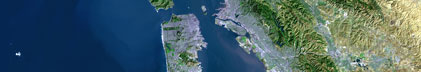
Location map
|

|
|
Bounding Coordinates
|
36.38886
-75.83333 -75.41666
35.20000
|
|
Ports
|
leave ?
arrive ?
|
|
Dates
|
02/25/2002 (JD 056) to 02/28/2002 (JD 059)
|
|
Analog Materials
|
No analog holdings.
|
|
Index map

|
|
|
Information Specialist
|
|
|
Crew
|
|
Jeff List
|
Chief Scientist, USGS Woods Hole
|
|
Kathy Weber
|
Scientist, USGS Woods Hole
|
|
|
Equipment Used
|
|
|
Purpose
|
|
Shoreline surveys along 130 km of Cape Hatteras
|
|
|
Summary
|
|
|
Notes
|
|
Navigation techniques: visual, along foreshore of beach
|
|
related web sites: http://woodshole.er.usgs.gov/operations/swash/
|
|
|
Publications
|
|
|
Got Help?
|
For 02003, we would appreciate any information on -- analog materials, contract, days at sea, dive count, funding, information to be derived, kms of navigation, national plan, NGDC Info, owner, project number, scanned materials, seismic description, station count, station description, submersible, tabulated info.
|
|