|
|
|
Metadata
|
|
ID
|
05002
|
|
Also Known As
|
05002
L-1-05-GM
URC/UNCW 2005-07B
|
|
Abstract
|
United States Geological Survey, Woods Hole, Massachusetts.
Chief Scientists: Kathryn Scanlon, Chris Koenig. Data
(camera, ROV, SCUBA) of field activity 05002 (L-1-05-GM) in
Gulf of Mexico, North America, North Atlantic from 03/21/2005
to 03/28/2005
|
|
Organization
|
United States Geological Survey, Woods Hole, Massachusetts
|
|
Project/Theme
|
Shelf-edge Habitats, NE Gulf of Mexico
|
|
Chief Scientist
|
Kathryn Scanlon
Chris Koenig
|
|
Platform
|
Liberty Star
|
|
Area of Operation
|
Gulf of Mexico, North America, North Atlantic
|
|
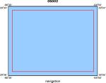
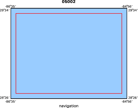
Location map
|
|
|
Bounding Coordinates
|
29.50000
-86.50000 -85.00000
28.50000
|
|
Ports
|
MAR 21, 2005 - St. Petersburg, FL
MAR 28, 2005 - St. Petersburg, FL
|
|
Dates
|
03/21/2005 (JD 080) to 03/28/2005 (JD 087)
|
|
Analog Materials
|
No analog holdings.
|
|
Index map
|
|
|
Information Specialist
|
|
|
Crew
|
|
Kathryn Scanlon
|
|
Chris Koenig
|
FSU chief scientist,
|
|
J. Knisel
|
GIS and data archive
|
|
Bren Wade
|
Captain
|
|
|
Equipment Used
|
|
|
Purpose
|
|
Collect sediment and rock samples from shelf-edge
|
|
|
Information to be Derived
|
|
Samples and Chemical Analysis;Age dates
|
|
|
Summary
|
|
The ROV was deployed at 19 sites both within the Madison
|
|
19 Stations Occupied.
|
|
|
Notes
|
|
Navigation Techniques: GPS
|
|
Navigation Techniques: All SCUBA diving operations were under direction of, and carried out by, NOAA personnel.
|
|
|
Got Help?
|
For 05002, we would appreciate any information on -- activity type, analog materials, contract, days at sea, dive count, funding, kms of navigation, national plan, NGDC Info, owner, project number, publications, scanned materials, seismic description, station count, station description, submersible, tabulated info.
|
|


