|
|
|
Metadata
|
|
ID
|
L-6-80-BS
|
|
Abstract
|
Chief Scientists: Alan Cooper, Mike Marlow. Geophysical
data (integratednavigation, bathgravmagnav, magnetics,
airgun, uniboom, 3dot5khz, 12khz, gravity, sonobuoy,
dopplersonar, RhoRho, transitsatellite, 24channel,
airgunmonitor) of field activity L-6-80-BS in North Bering
Sea, Alaska from 07/08/1980 to 07/28/1980
|
|
Chief Scientist
|
Alan Cooper
Mike Marlow
|
|
Activity Type
|
Geophysical
|
|
Platform
|
Samuel Phillips Lee
|
|
Area of Operation
|
North Bering Sea, Alaska
|
|
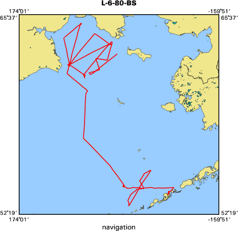
Location map
|

|
|
Bounding Coordinates
|
65.11386
179.90149 -165.72862
53.03430
|
|
Ports
|
leave Dutch Harbor, AK
arrive Nome, AK
|
|
Dates
|
07/08/1980 (JD 190) to 07/28/1980 (JD 210)
|
|
Analog Materials
|
list
|
|
Index map
|
|
|
Information Specialist
|
|
|
Crew
|
|
Aaron Dunwald
|
Chief Engineer
|
|
Alan Cooper
|
Chief Scientist
|
|
Dave Jones
|
Geologist
|
|
Eva Vanek
|
Navigator
|
|
Frank Johnson
|
Chief Mate
|
|
Gordon Tanner
|
Electronics Technician
|
|
Harold Magistrale
|
Geophysicist
|
|
Jackie Eaby
|
Navigator
|
|
Jill McCarthy
|
Dafe Curator
|
|
Jim Joyce
|
Geologist
|
|
Jon Greenberg
|
Geologist
|
|
Jon Childs
|
Geophysicist
|
|
Jon Erickson
|
Mechanical Technician
|
|
Meg Kingston
|
Navigator
|
|
Mike Marlow
|
Chief Scientist
|
|
Paul Wenberg
|
Mechanical Technician
|
|
Richard Heagney
|
Ship Captain
|
|
Roy Fields
|
Electronics Technician
|
|
|
Equipment Used
|
|
integratednavigation
|
|
bathgravmagnav
|
|
magnetics
|
|
airgun
|
|
uniboom
|
|
3dot5khz
|
|
12khz
|
|
gravity
|
|
sonobuoy
|
|
dopplersonar
|
|
RhoRho
|
|
transitsatellite
|
|
24channel
|
|
airgunmonitor
|
|
|
NGDC Overview
|
|
! Converted to time format with year at start.
|
|
!
|
|
DATA COLLECTION OVERVIEW (use NGDC GEODAS CD to retrieve data)
|
|
|
|
MCG Data Collection ID --- L680BS
|
|
Institution Data Collection ID --- L680BS
|
|
NGDC ID --- 06050036
|
|
Funding --- (unspecified)
|
|
Project, Cruise & Leg --- N.BERING SEA
|
|
Study region --- +66.00000,+53.00000,+179.00000,-165.00000
|
|
Chief Scientist(s) --- MIKE MARLOW, ALAN COOPER
|
|
Name of vessel --- Lee (surface ship)
|
|
Date field data collection started --- 07/06/80 DUTCH HARBOR,ALASKA
|
|
Date field data collection ended --- 08/01/80 NOME,ALASKA
|
|
Parameters surveyed ---
|
|
Bathymetry: surveyed, contained in data file
|
|
Magnetics: surveyed, contained in data file
|
|
Gravity: surveyed, contained in data file
|
|
High-resolution seismics: (unspecified)
|
|
Deep penetration seismics: surveyed, contained in data file
|
|
Format --- (I1,A8,F5.2,4I2,F5.3,F8.5,F9.5,I1,F6.4,F6.1,I2,i1,3F6.1,I1,F5.1,F6.0,F7.1,F6.1,F5.1,A8,4I1)
|
|
Date of data input to NGDC --- 06/12/87
|
|
Contributing institution --- USGS Branch of Pacific Marine Geology
|
|
Country --- United States
|
|
|
|
Navigation instrumentation --- SAT/LRNC/GYCOMP/SPDLOG/DOPPSONAR/RHO-RHO
|
|
Position determination method --- PRIM-SAT, SECOND-LORAN-C, DRS
|
|
|
|
Bathymetry instrumentation --- 3.5/12KHZ,1-4 SEC SWEEP,25/50 MS CESP
|
|
Additional forms of bathymetric data --- ANALOG RECORDS,MICROFILM
|
|
General rate of bathymetry in file --- 3.2 minutes
|
|
General collection rate of bathymetry --- 1-4 SECOND
|
|
Assumed sound velocity --- (unspecified)
|
|
Bathymetric datum code --- No correction applied (sea level)
|
|
Bathmetry interpolation scheme --- NO INTERPOLATION, DATA INTERVAL 1-5 MIN. W/INFLECTIONS
|
|
|
|
Magnetics instrumentation --- PROTON PRECESSION MAG-GEOMETRICS
|
|
Additional forms of magnetics data --- ANALOG RECORDS
|
|
General rate of magnetics in file --- 1.0 minutes
|
|
General collection rate of magnetics --- 4 seconds
|
|
Magnetic sensor tow distance --- 213 meters
|
|
Magnetic sensor depth --- (unspecified)
|
|
Two sensor horizontal separation --- (unspecified)
|
|
Residual magnetics reference field --- IGRF-75
|
|
Method of applying residual field --- MEASURED MAGS-(IGRF75 + ANNUAL CHANGES)
|
|
|
|
Gravity instrumentation --- L&R S-53
|
|
Additional forms of gravity data --- ANALOG STRIP CHARTS
|
|
General rate of gravity in file --- 1.0 minutes
|
|
General collection rate of gravity --- 20 seconds
|
|
Theoretical gravity formula --- IAG System 1967
|
|
Reference system --- (unspecified)
|
|
Corrections applied --- DRIFT CORR APPLIED START AND END
|
|
Starting land tie --- 968858.4 DUTCH HARBOR, AK
|
|
Ending land tie --- (unspecified value) NOME, AK
|
|
|
|
Seismic instrumentation --- 24-CHANN,2400M STREAMER,GUS 4200 DIG REC
|
|
Formats of seismic data --- 14 SECTIONS MICROFILM, POST-NAV PLOT
|
|
|
|
Notes ---
|
|
BATH-DATA DIGITIZED MANUALLY BY USGS UNDER CONTRACT TO DEFENCE MAPPING AGENCY
|
|
ITIZING INTERVAL VARIABLE, DEPENDING UPON GRADIENTS, BUT SAMPLES SHOULD BE
|
|
RECORDED AT LEAST EVERY 5 MIN.,WITH INFLECION POINTS. FOR INFOR CONTACT:
|
|
JON CHILDS, U.S.G.S. (703) 860-7241 OR (415) 856-7094
|
|
CDP RECORDED AT 2-MSEC,PROCESSED AT 4-MSEC. 1ST 10 SEC EDITED, STACKED,
|
|
DECONVOLVED,FILTERED,DISPLAYED. DIGITAL SHOT-PT NAV, DIGITAL TIME/VEL PAIRS.
|
|
|
Publications
|
|
Childs, J.R., Cooper, A.K., and Wright, A.W., 1981, Residual magnetic map of Umnak Plateau region,
|
southeastern Bering Sea: U.S. Geological Survey Geophysical Investigations Map GP-0939, 1 sheet.
|
|
|
Marlow, Michael S., Cooper, Alan K., and Childs, Jonathan R., 1981, Geophysical survey of
|
|
Anadyr and Navarin basins, northern Bering Sea, in 1981 American Association of Petroleum
|
|
Geologists annual convention with division; Society For Sedimentary Geology/EMD/DPA: American
|
Association of Petroleum Geologists Bulletin, v. 65, no. 5, p. 953.
|
|
|
Marlow, Michael S., Cooper, Alan K., and Childs, Jonathan R., 1983, Tectonic evolution of Gulf
|
|
of Anadyr and formation of Anadyr and Navarin basins: American Association of Petroleum
|
Geologists Bulletin, v. 67, no. 4, p. 646-665.
|
|
|
Marlow, Michael S., Cooper, A.K., Smith, G.L., and Chase, T.E., 1982, Multichannel
|
|
seismic-reflection profiles collected in 1980 in the northern Bering Sea: U.S. Geological
|
Survey Open-File Report 82-1090, 3 p.
|
|
|
Cooper, A.K., Marlow, M.S., and Magistrale, Harold, 1983, Digital gravity and magnetic data
|
|
collected in 1980 in the northern Bering Sea: U.S. Geological Survey Open-File Report 83-0519,
|
4 p.
|
|
|
Cooper, Alan K., Marlow, Michael S., Geist, Eric L., and Smith, Gregory L., 1991,
|
|
Multichannel seismic-reflection profiles collected in 1980 from southern Bering Sea,
|
Alaska: U.S. Geological Survey Open-File Report 91-0317, 4 p.
|
|
|
Got Help?
|
For L-6-80-BS, we would appreciate any information on -- contract, days at sea, dive count, funding, information to be derived, kms of navigation, national plan, notes, organization, owner, project, project number, purpose, scanned materials, seismic description, station count, station description, submersible, summary, tabulated info.
|
|


