|
! Converted to time format with year at start.
|
|
!
|
|
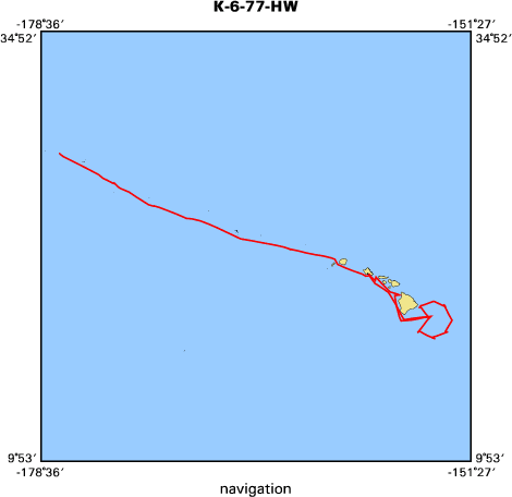
DATA COLLECTION OVERVIEW (use NGDC GEODAS CD to retrieve data)
|
|
|
|
MCG Data Collection ID --- K677HW
|
|
Institution Data Collection ID --- 77031706
|
|
NGDC ID --- 08010070
|
|
Funding --- NSF(HRS)
|
|
Project, Cruise & Leg --- HAWAIIAN RIDGE STUDY KK77-03-17-06
|
|
Study region --- +29.00000,+17.00000,-178.00000,-152.00000
|
|
Chief Scientist(s) --- F. K. DUENNEBIER
|
|
Name of vessel --- R/V KANA KEOKI (surface ship)
|
|
Date field data collection started --- 07/10/77 MIDWAY, U.S.A.
|
|
Date field data collection ended --- 07/21/77 HONOLULU, HAWAII
|
|
Parameters surveyed ---
|
|
Bathymetry: surveyed, contained in data file
|
|
Magnetics: surveyed, contained in data file
|
|
Gravity: surveyed, contained in data file
|
|
High-resolution seismics: surveyed, but not contained in data file
|
|
Deep penetration seismics: surveyed, but not contained in data file
|
|
Format --- (I1,A8,F5.2,4I2,F5.3,F8.5,F9.5,I1,F6.4,F6.1,I2,i1,3F6.1,I1,F5.1,F6.0,F7.1,F6.1,F5.1,A8,4I1)
|
|
Date of data input to NGDC --- 01/28/83
|
|
Contributing institution --- HAWAII INSTITUTE OF GEOPHYSICS
|
|
Country --- U.S.A.
|
|
|
|
Navigation instrumentation --- SATELLITE
|
|
Position determination method --- PRIM-SATELLITE
|
|
|
|
Bathymetry instrumentation --- 3.5 KHZ 30 DEG BEAM
|
|
Additional forms of bathymetric data --- ANALOG, MICROFILM
|
|
General rate of bathymetry in file --- 2.2 minutes
|
|
General collection rate of bathymetry --- 1/SECOND
|
|
Assumed sound velocity --- 1500.0 m/sec
|
|
Bathymetric datum code --- No correction applied (sea level)
|
|
Bathmetry interpolation scheme --- NONE.(PICKED PEAKS/TROUGHS OR 15-MIN INTERVLS IF SMOOTH)
|
|
|
|
Magnetics instrumentation --- GEOMETRICS G 801-3
|
|
Additional forms of magnetics data --- ANALOG, MICROFILM
|
|
General rate of magnetics in file --- 1.0 minutes
|
|
General collection rate of magnetics --- 6 seconds
|
|
Magnetic sensor tow distance --- (unspecified)
|
|
Magnetic sensor depth --- (unspecified)
|
|
Two sensor horizontal separation --- (unspecified)
|
|
Residual magnetics reference field --- IGRF-75
|
|
Method of applying residual field --- FOR EACH DATA VALUE
|
|
|
|
Gravity instrumentation --- LACOSTE ROMBERG S-33
|
|
Additional forms of gravity data --- ANALOG, MICROFLM
|
|
General rate of gravity in file --- 3.0 minutes
|
|
General collection rate of gravity --- 60 seconds
|
|
Theoretical gravity formula --- International 1930
|
|
Reference system --- Potsdam system
|
|
Corrections applied --- NONE APPLIED
|
|
Starting land tie --- 978939.2 HONOLULU, HAWAII PIER 45
|
|
Ending land tie --- 978939.2 HONOLULU, HAWAII PIER 45
|
|
|
|
Seismic instrumentation --- (SEE ADD.DOC. 18)
|
|
Formats of seismic data --- ANALOG, MICROFILM
|
|
|
|
Notes ---
|
|
09 120 AND 714 CU IN AIRGUN, 4500J SPKR, OBS, B,M,G, REFLX (HIGH 30-500,
|
|
09 FFTG, FFC.
|
|
15 GRAVITY BASE STATIONS IN GEORGE P. WOOLLARD AND JOHN C. ROSE
|
|
15 INTERNATIONAL GRAVITY MEASUREMENTS, MADISON, UNIV OF WISCONSIN, 1963
|
|
15 GRAVITY STILL METER 7182.2
|