|
|
|
Metadata
|
|
ID
|
02047
|
|
Also Known As
|
02047
R-1-02-MA
R102MA
|
|
Abstract
|
United States Geological Survey, Woods Hole, Massachusetts.
Chief Scientist: Rob Thieler. Geological data (3dot5khz,
sidescansonar, GPS, navigation, boomer, bathymetry) of field
activity 02047 (R-1-02-MA) in Vineyard Sound, Nantucket
Sound, Massachusetts, United States, North America, North
Atlantic from 06/05/2002 to 06/07/2002
|
|
Organization
|
United States Geological Survey, Woods Hole, Massachusetts
|
|
Chief Scientist
|
Rob Thieler
|
|
Activity Type
|
Geological
|
|
Platform
|
Rafael
|
|
Area of Operation
|
Vineyard Sound, Nantucket Sound, Massachusetts, United States, North America, North Atlantic
|
|
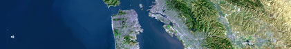
Location map
|

|
|
Bounding Coordinates
|
41.55000
-70.50000 -70.00000
41.40000
|
|
Ports
|
leave Jun 5, 2002 - Woods Hole, MA
arrive Jun 7, 2002 - Woods Hole, MA
|
|
Dates
|
06/05/2002 (JD 156) to 06/07/2002 (JD 158)
|
|
Analog Materials
|
No analog holdings.
|
|
Index map

|
|
|
Crew
|
|
Rob Thieler
|
Chief Scientist, USGS Woods Hole
|
|
Dave Nichols
|
Ship Captain, USGS Woods Hole
|
|
|
Equipment Used
|
|
3dot5khz
|
|
sidescansonar
|
|
GPS
|
|
navigation
|
|
boomer
|
|
bathymetry
|
|
|
Purpose
|
|
Map shallow geologic framework of L Hommedieu Shoal.
|
|
|
Summary
|
|
|
Notes
|
|
Navigation Techniques: DGPS
|
|
|
Got Help?
|
For 02047, we would appreciate any information on -- analog materials, contract, days at sea, dive count, funding, information specialist, information to be derived, kms of navigation, national plan, NGDC Info, owner, project, project number, publications, scanned materials, seismic description, station count, station description, submersible, tabulated info.
|
|