|
|
|
|
Metadata
|
|
ID
|
04002
|
|
Also Known As
|
04002
R-1-04-MA
R104MA
|
|
Abstract
|
United States Geological Survey, Woods Hole, Massachusetts.
Chief Scientists: Brad Butman, Jane Denny. Data (VanVeengrab,
GPS, navigation, 3dot5khz, sidescansonar, sidescansonar,
navigation, bathymetry, underwatertelevision,
underwatercamera) of field activity 04002 (R-1-04-MA) in
Gloucester to Nahant, South Essex Sanctuary, Massachusetts
Bay,Massachusetts, United States, North America, North
Atlantic from 04/12/2004 to 05/07/2004
|
|
Organization
|
United States Geological Survey, Woods Hole, Massachusetts
|
|
Project/Theme
|
South Essex Ocean Sanctuary Seafloor Mapping
|
|
Chief Scientist
|
Brad Butman
Jane Denny
|
|
Platform
|
Rafael
|
|
Area of Operation
|
Gloucester to Nahant, South Essex Sanctuary, Massachusetts Bay,
Massachusetts, United States, North America, North Atlantic
|
|
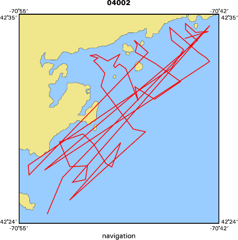
Location map
|

|
|
Bounding Coordinates
|
42.60000
-70.95000 -70.65000
42.40000
|
|
Ports
|
leave Gloucester, MA
arrive Gloucester, MA
|
|
Dates
|
04/12/2004 (JD 103) to 05/07/2004 (JD 128)
|
|
Analog Materials
|
No analog holdings.
|
|
Index map
|
|
|
Information Specialist
|
|
|
Crew
|
|
Brad Butman
|
Chief Scientist, USGS Woods Hole
|
|
Jane Denny
|
Chief Scientist, Mass CZM, USGS Woods Hole
|
|
Bill Danforth
|
Phase I (Geophysical) Acquisition, USGS Woods Hole
|
|
Chuck Worley
|
Phase I (Geophysical) Acquisition, USGS Woods Hole
|
|
Brian Andrews
|
Phase I (Geophysical) Acquisition, Processing, Acquisition mini-SEABOSS, Video/Stills, USGS Woods Hole
|
|
Dann Blackwood
|
Acquisition mini-SEABOSS, USGS Woods Hole
|
|
Seth Ackerman
|
Acquisition mini-SEABOSS, USGS Woods Hole
|
|
Kate McMullen
|
Processing-Sed Sample, USGS Woods Hole
|
|
Barry Irwin
|
Captain, Phase II (Ground Truth), USGS Woods Hole
|
|
|
Equipment Used
|
|
VanVeengrab
|
|
GPS
|
|
navigation
|
|
3dot5khz
|
|
sidescansonar
|
|
sidescansonar
|
|
navigation
|
|
bathymetry
|
|
underwatertelevision
|
|
underwatercamera
|
|
|
Purpose
|
|
Phase I- Complete geophysical mapping of the South Essex Sanctuary
|
|
(Gloucester to Nahant; 40 m to 10 m water depth) Phase II- Conduct ground
|
|
validation survey of 100 target stations in the survey area.
|
|
|
Information to be Derived
|
|
Grain size analysis; Habitat maps; Sea Floor Map; Bathymetric Maps;
|
|
Morphology;
|
|
|
Summary
|
|
Phase I Geophysical Survey: 8 total survey days with Submetrix,
|
|
Knudsen, Edgetech. Lost 5 days to rebuilding stbd engine on Rafael. Data
|
|
collected: Submetrix bathymetry/backscatter, Edgetech sidescan, Knudsen seismic
|
|
reflection. Phase II Ground Validation: Occupied 100 target stations in 3
|
|
survey days, recovered 56 sediment samples. Data collected: bottom video, bottom
|
|
stills, sediment samples (grain size). 100 Stations Occupied. 387 km continuous
|
|
data.
|
|
|
Publications
|
|
|
Got Help?
|
For 04002, we would appreciate any information on -- activity type, analog materials, contract, days at sea, dive count, funding, kms of navigation, national plan, NGDC Info, notes, owner, project number, scanned materials, seismic description, station count, station description, submersible, tabulated info.
|
|