|
|
|
Metadata
|
|
ID
|
A-4-04-HW
|
|
Abstract
|
United States Geological Survey, Menlo Park, California.
Chief Scientist: Curt Storlazzi. Geological data
(opticalbackscattersensor, wavepressure, CTmeter) of field
activity A-4-04-HW in West Maui, Hawaii, USA from 03/19/2004
to 03/19/2004
|
|
Organization
|
United States Geological Survey, Menlo Park, California
|
|
Project/Theme
|
Coral Reefs
|
|
Chief Scientist
|
Curt Storlazzi
|
|
Activity Type
|
Geological
|
|
Platform
|
Alyce C
|
|
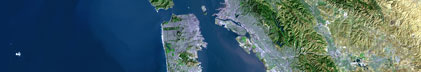
Area of Operation
|
West Maui, Hawaii, USA
|
|
Location map
|

|
|
Bounding Coordinates
|
21.01523
-156.69365 -156.63997
20.95078
|
|
Ports
|
leave Lahaina, Maui, Hawaii, USA
arrive Lahaina, Maui, Hawaii, USA
|
|
Dates
|
03/19/2004 (JD 079) to 03/19/2004 (JD 079)
|
|
Analog Materials
|
No analog holdings.
|
|
Index map

|
|
|
Information Specialist
|
|
|
Crew
|
|
Curt Storlazzi
|
Oceanographer/Geologist, USGS Western Region
|
|
Dana Wingfield
|
Geologist, USGS Western Region
|
|
Scot Lucas
|
Biologist, CAFG
|
|
Joe Reich
|
Vessel captain
|
|
|
Equipment Used
|
|
opticalbackscattersensor
|
|
wavepressure
|
|
CTmeter
|
|
|
Purpose
|
|
Oceanographic instrument package recovery and redeployment
|
|
|
Information to be Derived
|
|
Wave height, wave period, water depth, temperature, salinity, optical
|
|
backscatter
|
|
|
Summary
|
|
Maui instrument packages will be recovered from locations using the
|
|
vessel Alyce C. Data from the previous deployment will be downloaded.
|
|
|
Publications
|
|
Storlazzi, Curt, and Presto, M. Kathy, 2005, Coastal Circulation and Sediment
|
|
Dynamics along West Maui, Hawaii, U.S. Geological Survey Open File Report
|
|
2005-1068, PART IV: Measurements of waves, currents, temperature, salinity and
|
|
turbidity in Honolua Bay, Northwest Maui: 2003-2004, available on line at:
|
|
http://pubs.usgs.gov/of/2005/1068/
|
|
|
Got Help?
|
For A-4-04-HW, we would appreciate any information on -- analog materials, contract, days at sea, dive count, funding, kms of navigation, national plan, NGDC Info, notes, owner, project number, scanned materials, seismic description, station count, station description, submersible, tabulated info.
|
|