|
|
|
Metadata
|
|
ID
|
06005
|
|
Also Known As
|
06005
R-1-06-CD
|
|
Abstract
|
United States Geological Survey, Woods Hole, Massachusetts.
Chief Scientist: Larry Poppe. Data (SEABOSS, The small
SEABOSS grab, equipped with still and videl cameras, will be
used.) of field activity 06005 (R-1-06-CD) in Great Round
Shoal, Cape Cod, Massachusetts, United States,North America,
North Atlantic from 07/24/2006 to 07/27/2006
|
|
Organization
|
United States Geological Survey, Woods Hole, Massachusetts
|
|
Project/Theme
|
Great Round Shoal
|
|
Chief Scientist
|
Larry Poppe
|
|
Platform
|
Rafael
|
|
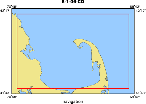
Area of Operation
|
Great Round Shoal, Cape Cod, Massachusetts, United States,
North America, North Atlantic
|
|
Location map
|

|
|
Bounding Coordinates
|
41.46667
-70.03333 -69.81667
41.40000
|
|
Ports
|
LEAVE Stage Harbor, Chatham, MA
ARRIVE Stage Harbor, Chatham, MA (TBD)
|
|
Dates
|
07/24/2006 (JD 205) to 07/27/2006 (JD 208)
|
|
Analog Materials
|
No analog holdings.
|
|
Index map
|
|
|
Information Specialist
|
|
|
Crew
|
|
Larry Poppe
|
Chief Scientist
|
|
Larry Poppe
|
Chief Scientist
|
|
Dave Foster
|
Ship Operator;
|
|
Dann Blackwood
|
Photographer
|
|
Kate McMullen
|
Science Technician
|
|
|
Equipment Used
|
|
SEABOSS
|
|
The small SEABOSS grab, e
|
(quipped with still and videl cameras)
|
|
will be used.
|
|
|
Purpose
|
|
Groundtruth NOAA multibeam survey H11079 of Great Round
|
|
Shoal with bottom sampling and photography.
|
|
|
Information to be Derived
|
|
Grain size analysis;Habitat maps;Sea Floor
|
|
Map;Morphology;Bottom Photography (still photos and video)Sediment
|
|
grain size analyses
|
|
|
Summary
|
|
A total of 32 stations were occupied. Bottom photography
|
|
was was collected at all of the stations; sediment samples were
|
|
collected at 28 of the stations.
|
|
|
Notes
|
|
3 days at sea.
|
|
32 stations occupied.
|
|
|
Funding
|
|
|
Got Help?
|
For 06005, we would appreciate any information on -- activity type, analog materials, contract, days at sea, dive count, kms of navigation, national plan, NGDC Info, owner, project number, publications, scanned materials, seismic description, station count, station description, submersible, tabulated info.
|
|


