|
|
|
Metadata
|
|
ID
|
F-3-06-MB
|
|
Abstract
|
United States Geological Survey, Pacific Science Center.
Chief Scientist: Curt Storlazzi. Redeployment data (AWAC) of
field activity F-3-06-MB in northern Monterey Bay from
11/29/2006 to 12/04/2006
|
|
Organization
|
United States Geological Survey, Pacific Science Center
|
|
Project/Theme
|
Pleasure Point
Coastal Change Hazards
|
|
Chief Scientist
|
Curt Storlazzi
|
|
Activity Type
|
Redeployment
|
|
Platform
|
Frontier
|
|
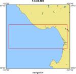
Area of Operation
|
northern Monterey Bay
|
|
Location map
|
|
|
Bounding Coordinates
|
37.00000
-122.50000 -121.75000
36.75000
|
|
Ports
|
LEAVE Santa Cruz small craft harbor
ARRIVE Santa Cruz small craft harbor
|
|
Dates
|
11/29/2006 (JD 333) to 12/04/2006 (JD 338)
|
|
Analog Materials
|
No analog holdings.
|
|
Index map

|
|
|
Information Specialist
|
|
|
Crew
|
|
Curt Storlazzi
|
|
Josh Logan
|
|
Kathy Presto
|
|
|
Equipment Used
|
|
|
Purpose
|
|
measure waves, currents and tides
|
|
|
Information to be Derived
|
|
waves, currents and tides
|
|
|
Notes
|
|
|
Publications
|
|
Storlazzi, C.D., Barnard, P.L., Collins, B.D., Finlayson, D.P., Golden, N.E.,
|
|
Hatcher, G.A., Kayen, R.E., and Ruggiero, Peter, 2007, High-Resolution
|
|
Topographic, Bathymetric, and Oceanographic Data for the Pleasure Point Area,
|
|
Santa Cruz County, California: 2005-2007, U.S. Geological Survey Open File
|
|
Report 2007-1270, available on line at:
|
|
http://pubs.usgs.gov/of
|
|
/2007/1270/
|
|
|
Got Help?
|
For F-3-06-MB, we would appreciate any information on -- analog materials, contract, days at sea, dive count, funding, kms of navigation, national plan, NGDC Info, owner, project number, scanned materials, seismic description, station count, station description, submersible, summary, tabulated info.
|
|


