|
|
|
Metadata
|
|
ID
|
69004
|
|
Also Known As
|
K-2-69-GM
69004
LEG_C
|
|
Abstract
|
Chief Scientists: Louis Garrison, Robert H. Fedden.
Geophysical data (sparker, magnetics, LoranA, navigation,
sextant, LoranC, 3dot5khz, tempsalinometer, radar) of field
activity 69004 (K-2-69-GM) in Gulf of Mexico from 03/04/1969
to 03/24/1969
|
|
Chief Scientist
|
Louis Garrison
Robert H. Fedden
|
|
Activity Type
|
Geophysical
|
|
Platform
|
Elisha Kane
|
|
Area of Operation
|
Gulf of Mexico
|
|
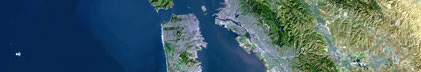
Location map
|

|
|
Bounding Coordinates
|
29.23500
-96.64666 -90.19000
18.53000
|
|
Ports
|
leave Gveracruz
arrive Galveston, TX
|
|
Dates
|
03/04/1969 (JD 063) to 03/24/1969 (JD 083)
|
|
Analog Materials
|
list
|
|
Index map

|
|
|
Crew
|
|
Louis Garrison
|
Chief Scientist, USGS Corpus Christi
|
|
Robert H. Fedden
|
Chief Scientist, NVO
|
|
Henry Berryhill
|
Scientist, USGS
|
|
Harry Hill
|
Scientist, USGS Western Region
|
|
Jack Lee
|
Scientist, USGS Western Region
|
|
Mike Marlow
|
Scientist, USGS Western Region
|
|
Bob Patrick
|
Scientist, USGS Western Region
|
|
Dave Scholl
|
Scientist, USGS Western Region
|
|
Dick Tagg
|
Scientist, USGS Western Region
|
|
|
Equipment Used
|
|
sparker
|
|
magnetics
|
|
LoranA
|
|
navigation
|
|
sextant
|
|
LoranC
|
|
3dot5khz
|
|
tempsalinometer
|
|
radar
|
|
|
Notes
|
|
This is Leg C of Phase 1.
|
|
|
Publications
|
|
Garrison, Louis E. and Martin, Ray G., Jr., 1973, Geologic structures
|
|
in the Gulf of Mexico Basin. U.S. Geological Survey Professional Paper
|
|
773, 85 p.
|
|
|
Got Help?
|
For 69004, we would appreciate any information on -- contract, days at sea, dive count, funding, information specialist, information to be derived, kms of navigation, national plan, NGDC Info, organization, owner, project, project number, purpose, scanned materials, seismic description, station count, station description, submersible, summary, tabulated info.
|
|