|
|
|
Metadata
|
|
ID
|
05042
|
|
Also Known As
|
05042
F-1-05-NR
|
|
Abstract
|
United States Geological Survey, Woods Hole, Massachusetts.
Chief Scientist: Rob Thieler. Data (sidescansonar, multibeam,
GPS) of field activity 05042 (F-1-05-NR) in Onslow Bay, North
Carolina, United States, North America, from 09/17/2005 to
09/22/2005
|
|
Organization
|
United States Geological Survey, Woods Hole, Massachusetts
|
|
Project/Theme
|
North Carolina Regional Coastal Erosion Studies
Coastal Change Hazards
|
|
Chief Scientist
|
Rob Thieler
|
|
Platform
|
4-Points
|
|
Area of Operation
|
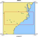
Onslow Bay, North Carolina, United States, North America,
|
|
Location map
|
|
|
Bounding Coordinates
|
37.00000
-84.75000 -74.25000
33.00000
|
|
Ports
|
SEP 17, 2005 - Wrightsville Beach, NC
SEP 22, 2005 - Wrightsville Beach, NC
|
|
Dates
|
09/17/2005 (JD 260) to 09/22/2005 (JD 265)
|
|
Analog Materials
|
No analog holdings.
|
|
Index map

|
|
|
Information Specialist
|
|
|
Crew
|
|
Rob Thieler
|
Chief Scientist
|
|
Tom O Brien
|
Senior Marine Tech
|
|
Dave Bernstein
|
Marine Tech
|
|
Chris Freeman
|
Captain
|
|
|
Equipment Used
|
|
sidescansonar
|
|
multibeam
|
|
GPS
|
|
|
Purpose
|
|
map inner shelf after hurricane ophelia
|
|
|
Notes
|
|
|
Got Help?
|
For 05042, we would appreciate any information on -- activity type, analog materials, contract, days at sea, dive count, funding, information to be derived, kms of navigation, national plan, NGDC Info, owner, project number, publications, scanned materials, seismic description, station count, station description, submersible, summary, tabulated info.
|
|


