|
|
|
Metadata
|
|
ID
|
05039
|
|
Also Known As
|
05039
D-1-05-LI
|
|
Abstract
|
United States Geological Survey, Woods Hole, Massachusetts.
Chief Scientist: Rick Rendigs. Data (pushcore) of field
activity 05039 (D-1-05-LI) in Western Long Island Sound, New
York, Connecticut, United from 10/14/2005 to 10/14/2005
|
|
Organization
|
United States Geological Survey, Woods Hole, Massachusetts
|
|
Chief Scientist
|
Rick Rendigs
|
|
Platform
|
Dottie J
|
|
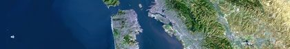
Area of Operation
|
Western Long Island Sound, New York, Connecticut, United
|
|
Location map
|

|
|
Bounding Coordinates
|
41.50000
-74.25000 -70.00000
40.25000
|
|
Ports
|
OCT 14, 2005 - King s Point, Great Neck NY
OCT 14, 2005 - King s Point ,Great Neck NY
|
|
Dates
|
10/14/2005 (JD 287) to 10/14/2005 (JD 287)
|
|
Analog Materials
|
No analog holdings.
|
|
Index map

|
|
|
Information Specialist
|
|
|
Crew
|
|
Rick Rendigs
|
Chief Scientist
|
|
Dann Blackwood
|
|
Mike Melcer
|
|
Pengfei Zhang
|
|
Henry Wong
|
|
Steffen Wojick
|
|
Chris Clausen
|
Captain
|
|
|
Equipment Used
|
|
|
Purpose
|
|
Obtain diver push cores from selected sites in Western Long
|
|
island Sound : Manhasset Harbor, Little Neck Harbor, and Hempstead
|
|
Harbor. Two cores from each site.
|
|
|
Information to be Derived
|
|
Determine down core concentration profiles of Chlordane and
|
|
DDT. Analyses performed by scientists at CCNY.
|
|
|
Summary
|
|
one dive at each site/ 2 cores collected at each site.
|
|
Total of 3 dives Total of 6 cores collected
|
|
|
Notes
|
|
Collected a total of six push cores of at least 50 cm. in
|
|
length. Bottom Sediments very silty and underwater visibility was
|
|
less than a few feet. The weather was lousy and the boat (32 ft.
|
|
Sport Fisherman) was clearly not rigged for dive operations, but in
|
|
true USGS fashion-we endeavored to endure and succeeded in spite of
|
|
ourselves!!!
|
|
|
Got Help?
|
For 05039, we would appreciate any information on -- activity type, analog materials, contract, days at sea, dive count, funding, kms of navigation, national plan, NGDC Info, owner, project, project number, publications, scanned materials, seismic description, station count, station description, submersible, tabulated info.
|
|