|
|
|
Metadata
|
|
ID
|
05030
|
|
Also Known As
|
05030
A-1-05-MA
|
|
Abstract
|
United States Geological Survey, Woods Hole, Massachusetts.
Chief Scientists: Dann Blackwood, Tim McCobb-
WRD-Northborough, Ma.. Data (SCUBA) of field activity 05030
(A-1-05-MA) in Ashumet Pond, Falmouth, Massachusetts, United
States, North America from 07/20/2005 to 07/20/2005
|
|
Organization
|
United States Geological Survey, Woods Hole, Massachusetts
|
|
Chief Scientist
|
Dann Blackwood
Tim McCobb- WRD-Northborough
|
|
Area of Operation
|
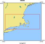
Ashumet Pond, Falmouth, Massachusetts, United States, North America
|
|
Location map
|
|
|
Bounding Coordinates
|
42.75000
-73.75000 -68.25000
41.00000
|
|
Ports
|
JUL 20, 2005 - Public Boat Ramp
JUL 20, 2005 - Public Boat Ramp
|
|
Dates
|
07/20/2005 (JD 201) to 07/20/2005 (JD 201)
|
|
Analog Materials
|
No analog holdings.
|
|
Index map

|
|
|
Information Specialist
|
|
|
Crew
|
|
Dann Blackwood
|
Chief Scientist, Captain
|
|
Tim McCobb
|
WRD-Northborough, Ma., Chief Scientist
|
|
Sandy Baldwin
|
|
|
Equipment Used
|
|
|
Purpose
|
|
Locate and connect monitoring wells to instruments.
|
|
|
Information to be Derived
|
|
|
Summary
|
|
All wells were located and measured. An additional well
|
|
that was considered lost was also located.
|
|
Installation of sampling tubes into pre-existing well heads
|
|
for sampling and flow monitoring.
|
|
|
Notes
|
|
Diving operations using ACHILLES INFLATABLE, in 10-15 ft. water using buddy system.
|
|
First Aid and DAN O2 emergency rescue kits on-site.
|
|
|
Got Help?
|
For 05030, we would appreciate any information on -- activity type, analog materials, contract, days at sea, dive count, funding, kms of navigation, national plan, NGDC Info, owner, platform, project, project number, publications, scanned materials, seismic description, station count, station description, submersible, tabulated info.
|
|


