|
|
|
Metadata
|
|
ID
|
R-1-97-GC
|
|
Abstract
|
Chief Scientist: Dave Rubin. Rotating Sidescan Sonar and
Sidescan Sonar data (sidescansonar, bathymetry, grab) of
field activity R-1-97-GC in Grand Canyon, Arizona from
05/21/1997 to 06/06/1997
|
|
Project/Theme
|
Grand Canyon Sedimentologic Engineering
|
|
National Plan
|
2.1.4 Marine Support Of National Park Service And Other
Doi Agencies, Fundamental Hazards Studies, Erosion
|
|
Chief Scientist
|
Dave Rubin
|
|
Activity Type
|
Rotating Sidescan Sonar and Sidescan Sonar
|
|
Platform
|
Raft
|
|
Area of Operation
|
Grand Canyon, Arizona
|
|
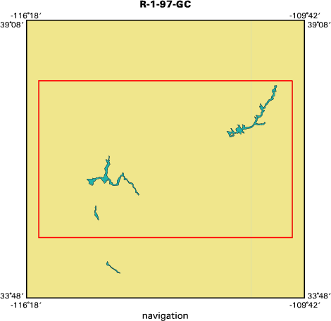
Location map
|

|
|
Bounding Coordinates
|
37.75000
-115.75000 -110.25000
35.25000
|
|
Dates
|
05/21/1997 (JD 141) to 06/06/1997 (JD 157)
|
|
Analog Materials
|
list
|
|
Index map
|
|
|
Information Specialist
|
|
Roberto Anima, Towed Sidesan Sonar Records
|
|
Dave Rubin, Rotating Sidescan Sonar Records And Samples
|
|
|
Crew
|
|
Dave Rubin
|
Chief Scientist, USGS Western Region
|
|
Roberto Anima
|
Unspecified, USGS Western Region
|
|
Carol Reiss
|
Unspecified, USGS Western Region
|
|
George Tate
|
Unspecified, USGS Western Region
|
|
Jim Bennett
|
Unspecified, USGS Western Region
|
|
Michael Hamer
|
Unspecified, USGS Western Region
|
|
Diane Minasian
|
Unspecified, USGS Western Region
|
|
Tom Lorenson
|
Unspecified, USGS Western Region
|
|
Dave Hogg
|
Unspecified, USGS Western Region
|
|
|
Equipment Used
|
|
sidescansonar
|
|
bathymetry
|
|
grab
|
|
|
Purpose
|
|
from the towed sidescan sonar, how sand
|
|
is redistributed in channel from last survey;
|
|
from the rotating sidescan sonar, tracking dune migration as indication of
|
|
bed load transport rate;
|
|
studying sed. structures of the predam flood deposits and to compare grainsize
|
|
evolution with grainsize evolution from the 1996 flood;
|
|
to monitor sediment along the river corridor;
|
|
to compare past side scanning sonar surveys with the present by looking at
|
|
changes along the river corridor
|
|
|
Information to be Derived
|
|
distribution of sediment along 17 pools of the corridor; bedform migration information along selected pools; information about primary sedimentary structures deposited during experimental flow event
|
|
|
Summary
|
|
sampling and sidesan sonar
|
|
|
Notes
|
|
|
Got Help?
|
For R-1-97-GC, we would appreciate any information on -- contract, days at sea, dive count, funding, kms of navigation, NGDC Info, organization, owner, ports, project number, publications, scanned materials, seismic description, station count, station description, submersible, tabulated info.
|
|


