|
|
|
Metadata
|
|
ID
|
P-1-97-MB
|
|
Abstract
|
Chief Scientist: Brian Edwards. Coring and Sampling data
(boxcore, 3dot5khz, YoNav, GPS, clamshellgrab) of field
activity P-1-97-MB in Monterey Bay National Marine Sanctuary
from 08/27/1997 to 09/05/1997
|
|
Project/Theme
|
Monterey Bay National Marine Sanctuary
|
|
Chief Scientist
|
Brian Edwards
|
|
Activity Type
|
Coring and Sampling
|
|
Platform
|
Point Sur
|
|
Area of Operation
|
Monterey Bay National Marine Sanctuary
|
|
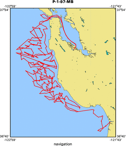
Location map
|

|
|
Bounding Coordinates
|
37.84360
-122.91206 -121.78513
36.72001
|
|
Dates
|
08/27/1997 (JD 239) to 09/05/1997 (JD 248)
|
|
Analog Materials
|
list
|
|
Index map
|
|
|
Information Specialist
|
|
|
Crew
|
|
Walter Barnhardt
|
Unspecified, USGS Western Region
|
|
Brian Edwards
|
Chief Scientist, USGS Western Region
|
|
Brad Carkin
|
Unspecified, USGS Western Region
|
|
Hank Chezar
|
Unspecified, USGS Western Region
|
|
Justin Friesner
|
Unspecified
|
|
Kaye Kinoshita
|
Unspecified, USGS Western Region
|
|
Greg Martz
|
Unspecified
|
|
Rebecca Preston
|
Unspecified
|
|
|
Equipment Used
|
|
boxcore
|
|
3dot5khz
|
|
YoNav
|
|
GPS
|
|
clamshellgrab
|
|
|
Purpose
|
|
Statistical sampling scheme for Monterey Bay Project
|
|
|
Notes
|
|
Excerpts from the WR CMG Bulletin (Publisher Mike Carr, Editor: Ann
|
|
Gartner)
|
|
|
|
11/7/97 -
|
|
|
|
CRUISE SUMMARY: MBNMS PROJECT
|
|
In late August and early September, the Monterey Bay National Marine
|
|
Sanctuary (MBNMS) project conducted two very successful 10-day back-to-
|
|
back cruises on the continental shelf between Carmel and the Golden Gate.
|
|
The first was a sampling cruise out of Moss Landing aboard the R/V Point
|
|
Sur, a UNOLS vessel. The second was a very high resolution seismic-
|
|
reflection cruise aboard the NOAA ship McArthur. During the sampling
|
|
leg, we recovered 175 box cores, grab samples, and bottom photographs
|
|
out of 226 sampling attempts. The samples were located at sites specified
|
|
by EPA's EMAP design criteria and represent the last of the statistically
|
|
sited coring for the MBNMS project. The geophysical leg was designed
|
|
to delineate the three-dimensional spatial distribution of areas of
|
|
sediment erosion, deposition, bypass, and outcrops within this shelf
|
|
region. We used the newly remodeled HUNTEC system to collect approximately
|
|
1400 trackline-km of very high resolution boomer data (centered in the
|
|
2-kHz to 2.5-kHz range). The system performed beautifully and provided high-quality data, at times to subbottom depths exceeding 100 m. Walter Barnhardt, Brad Carkin, Hank Chezar, Justin Friesner, Kaye Kinoshita,
|
|
Greg Martz, and Rebecca Preston, along with various MLML and UCSC
|
|
personnel, endured the grueling 12-hour coring watches with good cheer.
|
|
Roberto Anima was co-chief, and Kaye Kinoshita, Rebecca Preston, and
|
|
Glenn Spinelli provided support during the geophysical work. We conducted
|
|
the cruises at a time when MARFAC was hard pressed with the BASIX III
|
|
operation. Fred Payne served ably as both ET and MT during the sampling
|
|
leg. Fred Payne, Mike Boyle, and Graham Standen (GEOFORCE tech) got to
|
|
play with the HUNTEC system during the geophysical leg. I thank MARFAC
|
|
and particularly Fred and Mike for their help in making both these
|
|
cruises successful.- Brian Edwards
|
|
|
Publications
|
|
Reid, J.A., Reid, J.M., Jenkins, C.J., Zimmermann, M., Williams, S.J., and
|
|
Field, M.E., 2006, usSEABED: Pacific Coast (California, Oregon, Washington)
|
|
offshore surficial-sediment data release, U.S. Geological Survey Data Series
|
|
182, version 1.0. Online at:
|
|
|
http://pubs.usgs.gov/ds/2006/182/
|
|
|
Orzech, K.M., Dahl, W.E., and Edwards, B.D., 2001, Core Descriptions,
|
|
Core Photographs, Physical Property Logs and Surface Textural Data of
|
|
Sediment Cores Recovered from the Continental Shelf of the Monterey Bay
|
|
National Marine Sanctuary During Research Cruises M-1-95-MB, P-2-95-MB,
|
|
and P-1-97-MB, US Geological Survey
|
Openfile report 01-107:
|
|
http://geopubs.wr.usgs.gov/open-file/of01-107/
|
|
|
Got Help?
|
For P-1-97-MB, we would appreciate any information on -- contract, days at sea, dive count, funding, information to be derived, kms of navigation, national plan, NGDC Info, organization, owner, ports, project number, scanned materials, seismic description, station count, station description, submersible, summary, tabulated info.
|
|


