|
|
|
Metadata
|
|
ID
|
L-1-97-SF
|
|
Also Known As
|
TIB97
|
|
Abstract
|
Chief Scientist: Dave Cacchione. Geoprobe Deployment data
(Geoprobe, MarshMcBirney, temperature, pressuresensor,
opticalbackscattersensor, transmissometer, altimeter, ADP,
sidescansonar, CTDmeter) of field activity L-1-97-SF in San
Francisco Bay, CA from 12/06/1997 to 12/06/1997
|
|
Chief Scientist
|
Dave Cacchione
|
|
Activity Type
|
Geoprobe Deployment
|
|
Platform
|
White Lightning
|
|
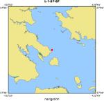
Area of Operation
|
San Francisco Bay, CA
|
|
Location map
|
|
|
Bounding Coordinates
|
37.88667
-122.43717 -122.43717
37.88667
|
|
Dates
|
12/06/1997 (JD 340) to 12/06/1997 (JD 340)
|
|
Analog Materials
|
No analog holdings.
|
|
Index map

|
|
|
Information Specialist
|
|
|
Crew
|
|
Dave Cacchione
|
Chief Scientist, USGS Western Region
|
|
Dave Rubin
|
Geologist, USGS Western Region
|
|
Joanne Thede Ferreira
|
Geophysicist, USGS Western Region
|
|
George Tate
|
Geologist, USGS Western Region
|
|
Rick Viall
|
Electronics Technician, USGS Western Region
|
|
|
Equipment Used
|
|
Geoprobe
|
|
MarshMcBirney
|
|
temperature
|
|
pressuresensor
|
|
opticalbackscattersensor
|
|
transmissometer
|
|
altimeter
|
|
ADP
|
|
sidescansonar
|
|
CTDmeter
|
|
|
Summary
|
|
The tripod was deployed on the bay floor for 11 days, measuring water
|
|
currents and other oceanographic parameters and recording thousands of rotating
|
|
sidescan images to track the movement of underwater sand dunes. The project is
|
|
part of a larger study designed to reveal how sediment and pollutants move
|
|
through San Francisco Bay.
|
|
|
Notes
|
|
Expected date of recovery 12/17/97.
|
|
Instruments in geoprobe instrument package:
|
|
4 marsh-mcbirney electromagnetic current meters (1/2 hr. measurements),
|
|
2 temperature sensors (1/2 hr. measurements),
|
|
1 parascientific pressure sensor (1/2 hr. measurements),
|
|
5 optical backscattering sensors (1/2 hr. measurements),
|
|
3 led transmissometers(1/2 hr. measurements),
|
|
1 bottom-looking altimeter (1/2 hr. measurements),
|
|
1 upward-looking acoustic doppler profiler (continuous 10 minute averages),
|
|
1 rotating sidescan sonar (1/2 hr. measurements),
|
|
1 ocean sensors ctd (5 minute measurements)
|
|
|
Got Help?
|
For L-1-97-SF, we would appreciate any information on -- analog materials, contract, days at sea, dive count, funding, information to be derived, kms of navigation, national plan, NGDC Info, organization, owner, ports, project, project number, publications, purpose, scanned materials, seismic description, station count, station description, submersible, tabulated info.
|
|


