|
|
|
Metadata
|
|
ID
|
94038
|
|
Also Known As
|
94038
ELUS94-1
E-1-94-NR
|
|
Abstract
|
United States Geological Survey, Woods Hole, Massachusetts.
Chief Scientists: Bill Schwab, Rob Thieler. Data (navigation)
of field activity 94038 (E-1-94-NR) in North Carolina
Wrightsville Beach from 03/07/1994 to 03/12/1994
|
|
Organization
|
United States Geological Survey, Woods Hole, Massachusetts
|
|
Project/Theme
|
Exclusive Economic Zones (EEZ)
|
|
Chief Scientist
|
Bill Schwab
Rob Thieler
|
|
Platform
|
Elusive
|
|
Area of Operation
|
North Carolina Wrightsville Beach
|
|
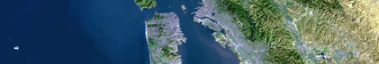
Location map
|

|
|
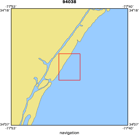
Bounding Coordinates
|
34.22442
-77.80049 -77.76108
34.18379
|
|
Dates
|
03/07/1994 (JD 066) to 03/12/1994 (JD 071)
|
|
Analog Materials
|
No analog holdings.
|
|
Index map
|
|
|
Crew
|
|
Bill Schwab
|
Chief Scientist, USGS Woods Hole
|
|
Rob Thieler
|
Chief Scientist, Duke
|
|
Dan Aspenleiter
|
Captain, NOAA-NURC-UNCW
|
|
Bill Danforth
|
Image Proc, USGS Woods Hole
|
|
Dave Nichols
|
Tech, USGS Woods Hole
|
|
Barry Irwin
|
Nav Tech, USGS Woods Hole
|
|
Mead Allison
|
Image Proc. USGS Woods Hole
|
|
Andrew Brill
|
Unspecified, Duke
|
|
|
Equipment Used
|
|
|
Purpose
|
|
Side scan sonar, QMIPS, sample
|
|
|
Publications
|
|
Cruise Report exists at Woods Hole
|
|
|
Got Help?
|
For 94038, we would appreciate any information on -- activity type, analog materials, contract, days at sea, dive count, funding, information specialist, information to be derived, kms of navigation, national plan, NGDC Info, notes, owner, ports, project number, scanned materials, seismic description, station count, station description, submersible, summary, tabulated info.
|
|