|
|
|
Metadata
|
|
ID
|
03047
|
|
Also Known As
|
03047
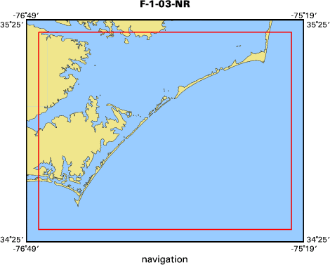
F-1-03-NR
|
|
Abstract
|
United States Geological Survey, Woods Hole, Massachusetts.
Chief Scientist: Rob Thieler. Data (Sidescan-Klien, EM3000
multibeam) of field activity 03047 (F-1-03-NR) in Raleigh
Bay, North Carolina, United States, North America, North
Atlantic from 00/23/2003 to 00/01/2003
|
|
Organization
|
United States Geological Survey, Woods Hole, Massachusetts
|
|
Project/Theme
|
North Carolina Regional Coastal Erosion Studies
Coastal Change Hazards
|
|
Chief Scientist
|
Rob Thieler
|
|
Platform
|
4Points
|
|
Area of Operation
|
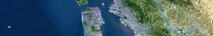
Raleigh Bay, North Carolina, United States, North America, North Atlantic
|
|
Location map
|
|
|
Bounding Coordinates
|
35.36000
-76.75000 -75.38000
34.48000
|
|
Ports
|
SEP 23, 2003 (JD 266) Ocracoke, NC
OCT 1, 2003 (JD 274) Ocracoke, NC
|
|
Dates
|
00/23/2003 (JD 000) to 00/01/2003 (JD 000)
|
|
Analog Materials
|
No analog holdings.
|
|
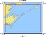
Index map
|
|
|
Information Specialist
|
|
|
Crew
|
|
Rob Thieler
|
Chief Scientist
|
|
E. Hammar-Klose
|
data processing
|
|
T. O Brien
|
marine tech
|
|
Chris Freeman
|
Captain
|
|
|
Equipment Used
|
|
Sidescan-Klien
|
|
EM3000 multibeam
|
|
|
Purpose
|
|
Post-hurricane Isabel seafloor mapping survey.
|
|
|
Information to be Derived
|
|
Sea Floor Map;Bathymetric Maps;Morphology;
|
|
|
Notes
|
|
Navigation Techniques: DGPS
|
|
|
Publications
|
|
|
Got Help?
|
For 03047, we would appreciate any information on -- activity type, analog materials, contract, days at sea, dive count, funding, kms of navigation, national plan, NGDC Info, owner, project number, scanned materials, seismic description, station count, station description, submersible, summary, tabulated info.
|
|