|
|
|
Metadata
|
|
ID
|
03053
|
|
Also Known As
|
03053
A-3-03-MA
A303MA
|
|
Abstract
|
United States Geological Survey, Woods Hole,
Massachusetts,Woods Hole Oceanographic Institution. Chief
Scientist: Dave Foster. Geophysical data (3dot5khz, Chirp,
GPS) of field activity 03053 (A-3-03-MA) in Vineyard Sound,
Massachusetts, United States, North America, North Atlantic
from 11/04/2003 to 11/07/2003
|
|
Organization
|
United States Geological Survey, Woods Hole, Massachusetts
Woods Hole Oceanographic Institution
|
|
Project/Theme
|
Seafloor Mapping
|
|
Chief Scientist
|
Dave Foster
|
|
Activity Type
|
Geophysical
|
|
Platform
|
Asterias
|
|
Area of Operation
|
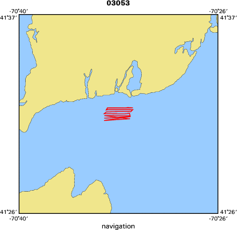
Vineyard Sound, Massachusetts, United States, North America, North Atlantic
|
|
Location map
|

|
|
Bounding Coordinates
|
41.53714
-70.56339 -70.52886
41.52557
|
|
Ports
|
leave Woods Hole, MA
arrive Woods Hole, MA
|
|
Dates
|
11/04/2003 (JD 308) to 11/07/2003 (JD 311)
|
|
Analog Materials
|
No analog holdings.
|
|
Index map
|
|
|
Information Specialist
|
|
|
Crew
|
|
Dave Foster
|
Chief Scientist, USGS Woods Hole
|
|
Tom O'Brien
|
Tech, USGS Woods Hole
|
|
Stephen Swift
|
watch stander, WHOI
|
|
|
Equipment Used
|
|
|
Purpose
|
|
Testing Chirp subbottom systems. We will be comparing the Knudsen 320BR
|
|
system with the Edgetech 512i system. The Knudsen 320BR is being deployed from
|
|
the RV Rafael.
|
|
|
Information to be Derived
|
|
|
Summary
|
|
35 km of Edgetech 512i Chirp data collected and stored on CD-R.
|
|
|
Got Help?
|
For 03053, we would appreciate any information on -- analog materials, contract, days at sea, dive count, funding, kms of navigation, national plan, NGDC Info, notes, owner, project number, publications, scanned materials, seismic description, station count, station description, submersible, tabulated info.
|
|


