|
|
|
Metadata
|
|
ID
|
04045
|
|
Also Known As
|
04045
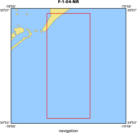
F-1-04-NR
|
|
Abstract
|
United States Geological Survey, Woods Hole, Massachusetts.
Chief Scientist: Rob Thieler. Data (Sidescan-Klien, EM3000
multibeam, DGPS and RTK navigation) of field activity 04045
(F-1-04-NR) in Raleigh Bay, North Carolina, United States,
North America, from 08/06/2004 to 08/08/2004
|
|
Organization
|
United States Geological Survey, Woods Hole, Massachusetts
|
|
Project/Theme
|
North Carolina Regional Coastal Erosion Studies
Coastal Change Hazards
|
|
Chief Scientist
|
Rob Thieler
|
|
Platform
|
4-POINTS
|
|
Area of Operation
|
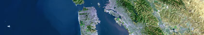
Raleigh Bay, North Carolina, United States, North America,
|
|
Location map
|

|
|
Bounding Coordinates
|
35.10000
-76.00000 -75.90000
34.90000
|
|
Ports
|
AUG 6, 2004 - Ocracoke, NC
AUG 8, 2004 - Ocracoke, NC
|
|
Dates
|
08/06/2004 (JD 219) to 08/08/2004 (JD 221)
|
|
Analog Materials
|
No analog holdings.
|
|
Index map
|
|
|
Information Specialist
|
|
|
Crew
|
|
Rob Thieler
|
Chief Scientist
|
|
Emile Bergeron
|
Mar. Tech.
|
|
Chris Freeman
|
Captain
|
|
|
Equipment Used
|
|
Sidescan-Klien
|
|
EM3000 multibeam, DGPS an
|
(d RTK navigation)
|
|
|
Purpose
|
|
map inner shelf response to hurricane Alex
|
|
|
Information to be Derived
|
|
Sea Floor Map;Bathymetric Maps;
|
|
|
Summary
|
|
mapped seafloor previously mapped in 2003 and 2004.
|
|
|
Notes
|
|
Navigation Techniques: DGPS/RTK GPS
|
|
|
Got Help?
|
For 04045, we would appreciate any information on -- activity type, analog materials, contract, days at sea, dive count, funding, kms of navigation, national plan, NGDC Info, owner, project number, publications, scanned materials, seismic description, station count, station description, submersible, tabulated info.
|
|