|
|
|
Metadata
|
|
ID
|
93027
|
|
Also Known As
|
93027
JENA93-2
J-2-93-PR
|
|
Abstract
|
United States Geological Survey, Woods Hole, Massachusetts.
Chief Scientist: Kathy Scanlon. Data (navigation) of field
activity 93027 (J-2-93-PR) in Puerto Rico Humacao from
11/06/1993 to 11/12/1993
|
|
Organization
|
United States Geological Survey, Woods Hole, Massachusetts
|
|
Project/Theme
|
Puerto Rico Insular Shelf Studies
|
|
Chief Scientist
|
Kathy Scanlon
|
|
Platform
|
Jean A
|
|
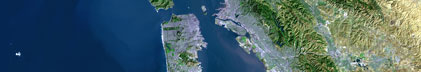
Area of Operation
|
Puerto Rico Humacao
|
|
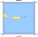
Location map
|
|
|
Bounding Coordinates
|
21.00000
-69.00000 -63.00000
15.25000
|
|
Dates
|
11/06/1993 (JD 310) to 11/12/1993 (JD 316)
|
|
Analog Materials
|
No analog holdings.
|
|
Index map

|
|
|
Crew
|
|
Kathy Scanlon
|
Chief Scientist, USGS Woods Hole
|
|
Richie Paul
|
Captain, PR DNR
|
|
Milton Carlo
|
Unspecified, USGS Puerto Rico
|
|
Juan Trias
|
Unspecified, USGS Puerto Rico
|
|
Barry Irwin
|
Unspecified, USGS Woods Hole
|
|
Ken Parolski
|
Unspecified, USGS Woods Hole
|
|
|
Equipment Used
|
|
|
Purpose
|
|
|
Publications
|
|
Cruise Report exists at Woods Hole
|
|
|
Got Help?
|
For 93027, we would appreciate any information on -- activity type, analog materials, contract, days at sea, dive count, funding, information specialist, information to be derived, kms of navigation, national plan, NGDC Info, notes, owner, ports, project number, scanned materials, seismic description, station count, station description, submersible, summary, tabulated info.
|
|