|
|
|
Metadata
|
|
ID
|
91036
|
|
Also Known As
|
91036
WTHT91-3
H-3-91-MY
|
|
Abstract
|
United States Geological Survey, Woods Hole,
Massachusetts,Massachusetts Water Resources Authority. Chief
Scientist: Mike Bothner. Geological data (tripod, core,
VanVeengrab, sedimenttrap, GPS) of field activity 91036
(H-3-91-MY) in Western Massachusetts Bay from 10/16/1991 to
10/17/1991
|
|
Organization
|
United States Geological Survey, Woods Hole, Massachusetts
Massachusetts Water Resources Authority
|
|
Project/Theme
|
Massachusetts Bay Experiment
|
|
Chief Scientist
|
Mike Bothner
|
|
Activity Type
|
Geological
|
|
Platform
|
White Heath
|
|
Area of Operation
|
Western Massachusetts Bay
|
|
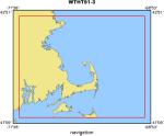
Location map
|
|
|
Bounding Coordinates
|
42.75000
-71.50000 -69.00000
41.25000
|
|
Ports
|
leave Boston, MA
arrive Boston, MA
|
|
Dates
|
10/16/1991 (JD 289) to 10/17/1991 (JD 290)
|
|
Analog Materials
|
No analog holdings.
|
|
Index map

|
|
|
Information Specialist
|
|
|
Crew
|
|
Mike Bothner
|
Chief Scientist, USGS Woods Hole
|
|
Adam Brown
|
Unspecified, USGS Woods Hole
|
|
Marinna Martini
|
Unspecified, USGS Woods Hole
|
|
Barry Irwin
|
Unspecified, USGS Woods Hole
|
|
Carol Parmenter
|
Unspecified, USGS Woods Hole
|
|
Rick Rendigs
|
Unspecified, USGS Woods Hole
|
|
Bill Strahle
|
Unspecified, USGS Woods Hole
|
|
W. Smith
|
Unspecified, MWRA
|
|
|
Equipment Used
|
|
tripod
|
|
core
|
|
VanVeengrab
|
|
sedimenttrap
|
|
GPS
|
|
|
Purpose
|
|
Recover and deploy tripod, samples, cores.
|
|
|
Got Help?
|
For 91036, we would appreciate any information on -- analog materials, contract, days at sea, dive count, funding, information to be derived, kms of navigation, national plan, NGDC Info, notes, owner, project number, publications, scanned materials, seismic description, station count, station description, submersible, summary, tabulated info.
|
|


